Bear River (Georgia)
Jump to navigation
Jump to search
| Bear River | |
|---|---|
| Location | |
| Country | United States |
| Physical characteristics | |
| Source | |
| • location | Georgia |
| Mouth | |
• coordinates | 31°43′35″N 81°09′08″W / 31.72633°N 81.15232°W |
• elevation | 0 ft (0 m) |
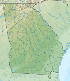
The Bear River is a 13-mile-long (21 km)[1] tidal river in the U.S. state of Georgia. It forms the channel that separates Ossabaw Island from the Georgia mainland, connecting with the Ogeechee River at its north end and the Medway River at its south.[2][3]
See also
References
- ^ U.S. Geological Survey. National Hydrography Dataset high-resolution flowline data. The National Map Archived 2012-03-29 at the Wayback Machine, accessed April 26, 2011
- ^ *U.S. Geological Survey Geographic Names Information System: Bear River
- ^ USGS Hydrologic Unit Map - State of Georgia (1974)
