Yosemite, Kentucky
Jump to navigation
Jump to search
Yosemite | |
|---|---|
 Post office in Yosemite, Kentucky | |
 Yosemite Location within the state of Kentucky  Yosemite Yosemite (the United States) | |
| Coordinates: 37°20′48″N 84°49′29″W / 37.34667°N 84.82472°W | |
| Country | United States |
| State | Kentucky |
| County | Casey |
| Elevation | 840 ft (260 m) |
| Time zone | UTC-5 (Eastern (EST)) |
| • Summer (DST) | UTC-4 (EST) |
| ZIP codes | 42566 |
| GNIS feature ID | 507236[1] |
Yosemite is an unincorporated community in eastern Casey County, Kentucky, United States. Their Post Office was closed in September 2011.[2] It was established in the 1870s for logging facilities owned by Cincinnati businessman Eugene Zimmerman. It was named by his daughter Helena, who said the hilly area reminded her of the Yosemite valley in California.
Locals in the area pronounce the town "YO-suh-MITE", differing from the California pronunciation.
References
- ^ U.S. Geological Survey Geographic Names Information System: Yosemite, Kentucky
- ^ Error Occurred While Processing Request at the Wayback Machine (archived November 27, 2003)[dead link]
Municipalities and communities of Casey County, Kentucky, United States | ||
|---|---|---|
| City | 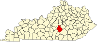 | |
| Unincorporated Communities | ||
| Ghost Towns | ||
This Casey County, Kentucky state location article is a stub. You can help Wikipedia by expanding it. |
Categories:
- Pages using gadget WikiMiniAtlas
- Webarchive template wayback links
- All articles with dead external links
- Articles with dead external links from September 2016
- Use mdy dates from July 2023
- Articles with short description
- Short description is different from Wikidata
- Coordinates on Wikidata
- Unincorporated communities in Casey County, Kentucky
- Unincorporated communities in Kentucky
- All stub articles
- Kentucky geography stubs