Wood, Pennsylvania
Jump to navigation
Jump to search
Wood, Pennsylvania | |
|---|---|
Unincorporated community | |
 Wood  Wood | |
| Coordinates: 40°10′06″N 78°08′11″W / 40.16833°N 78.13639°W | |
| Country | United States |
| State | Pennsylvania |
| Counties | Bedford, Fulton, Huntingdon |
| Townships | Broad Top, Wells, Wood |
| Elevation | 1,880 ft (570 m) |
| Time zone | UTC-5 (Eastern (EST)) |
| • Summer (DST) | UTC-4 (EDT) |
| ZIP code | 16694 |
| Area code | 814 |
| GNIS feature ID | 1191714[1] |
Wood is an unincorporated community in the U.S. state of Pennsylvania; portions of the community lie in Bedford, Fulton, and Huntingdon counties.[1] The community is 2.4 miles (3.9 km) south of Broad Top City. Wood has a post office with ZIP code 16694, which opened on September 9, 1908.[2][3]
References
- ^ a b "Wood". Geographic Names Information System. United States Geological Survey, United States Department of the Interior.
- ^ United States Postal Service. "USPS - Look Up a ZIP Code". Retrieved July 23, 2017.
- ^ "Postmaster Finder - Post Offices by ZIP Code". United States Postal Service. Retrieved July 23, 2017.
Municipalities and communities of Bedford County, Pennsylvania, United States | ||
|---|---|---|
| Boroughs |  | |
| Townships | ||
| CDPs | ||
| Unincorporated communities | ||
| Footnotes | ‡This populated place also has portions in an adjacent county or counties | |
Municipalities and communities of Fulton County, Pennsylvania, United States | ||
|---|---|---|
| Boroughs | 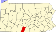 | |
| Townships | ||
| CDP | ||
| Unincorporated communities | ||
| Footnotes | ‡This populated place also has portions in an adjacent county or counties | |
Municipalities and communities of Huntingdon County, Pennsylvania, United States | ||
|---|---|---|
| Boroughs |  | |
| Townships | ||
| CDPs | ||
| Unincorporated communities | ||
| Ghost town | ||
| Footnotes | ‡This populated place also has portions in an adjacent county or counties | |
This Bedford County, Pennsylvania state location article is a stub. You can help Wikipedia by expanding it. |
Categories:
- Use mdy dates from July 2023
- Articles with short description
- Short description is different from Wikidata
- Coordinates on Wikidata
- Unincorporated communities in Bedford County, Pennsylvania
- Unincorporated communities in Fulton County, Pennsylvania
- Unincorporated communities in Huntingdon County, Pennsylvania
- Unincorporated communities in Pennsylvania
- All stub articles
- Western Pennsylvania geography stubs