Violet, Louisiana
Violet | |
|---|---|
Census-designated place | |
 Old Our Lady of Lourdes Church Building, Violet | |
 Location in St. Bernard Parish and the state of Louisiana. | |
| Coordinates: 29°54′04″N 89°53′49″W / 29.90111°N 89.89694°W | |
| Country | United States |
| State | Louisiana |
| Parish | St. Bernard |
| Area | |
| • Total | 4.57 sq mi (11.85 km2) |
| • Land | 3.93 sq mi (10.17 km2) |
| • Water | 0.65 sq mi (1.68 km2) |
| Elevation | 3 ft (0.9 m) |
| Population (2020) | |
| • Total | 5,758 |
| • Density | 1,466.63/sq mi (566.28/km2) |
| Time zone | UTC-6 (CST) |
| • Summer (DST) | UTC-5 (CDT) |
| Area code | 504 |
| FIPS code | 22-78855 |
Violet is a census-designated place (CDP) in St. Bernard Parish, Louisiana, United States. The population was 5,758 at the 2020 census.[2] Violet is located on the east bank of the Mississippi River, approximately 7.5 miles (12.1 km) southeast of New Orleans and is part of the New Orleans–Metairie–Kenner metropolitan statistical area.
History
The area now known as Violet was originally part of the Livaudais Plantation. Violet sprang up after the development of the Violet Canal. It was named by canal booster Albert Covington Janin, after his wife Violet Blair Janin, a Washington, D.C. socialite and part of the influential Blair family for whom the Blair House across from the White House in Washington D.C. is named.[3] Albert Janin spent his youth in St. Bernard Parish in the large Janin family home. His father, Louis Janin, Sr., a prominent lawyer who had immigrated from France to New Orleans in 1828, sent his sons to Europe for their education, including Albert. Albert was a partner with his father's law firm, including the office in Washington, D. C., where he remained after marrying into the Blair family. His and Violet's life together is told in Virginia Jean Laas's book, Love and Power in the Nineteenth Century, the Marriage of Violet Blair.
Hurricane Katrina
On August 29, 2005, the community was devastated by storm surge and wind associated with Hurricane Katrina which topped the Hurricane Protection Levee and destroyed the Mississippi River-Gulf Outlet Canal (MRGO) levee. Camp Hope housed volunteers assisting residents of St. Bernard Parish in their recovery from Hurricane Katrina. It was located at the W. Smith Elementary School, 6701 E. St. Bernard Highway.
Geography
Violet is located at 29°54′4″N 89°53′49″W / 29.90111°N 89.89694°W (29.901244, -89.896860), in southern Louisiana on the Gulf Coast.[4] According to the United States Census Bureau, the CDP has a total area of 4.5 square miles (11.8 km2), of which 4.1 square miles (10.5 km2) is land and 0.5 square mile (1.2 km2) (10.57%) is water.
Economy
Violet is the proposed location[5] of the Louisiana International Terminal Project, designed to allow the largest of global container ships a location on the lower Mississippi at which to berth.
Demographics
| Census | Pop. | Note | %± |
|---|---|---|---|
| 2020 | 5,758 | — | |
| U.S. Decennial Census[6] | |||
| Race | Number | Percentage |
|---|---|---|
| White (non-Hispanic) | 1,590 | 27.61% |
| Black or African American (non-Hispanic) | 3,542 | 61.51% |
| Native American | 34 | 0.59% |
| Asian | 35 | 0.61% |
| Other/Mixed | 181 | 3.14% |
| Hispanic or Latino | 376 | 6.53% |
At the 2000 United States census, there were 8,555 people, 2,744 households, and 2,266 families residing in the CDP. After Hurricane Katrina struck in 2005, the 2010 U.S. census determined its population declined to 4,973.[8] The 2019 American Community Survey estimated its population rebounded to 5,755.[9] In 2020, its population was 5,758.[2] Among its population, the median age was 37.7, and 73.8% of the population were aged 18 and older. An estimated 6.6% were aged 5 and under, and 13.3% aged 65 and older.
The racial and ethnic makeup of the census-designated place was 64.5% Black and African American, 31.8% non-Hispanic white, 3.1% some other race, and 0.7% two or more races. Hispanic and Latin Americans of any race made up 7.6% of the population.[10] In 2000, the racial makeup of the CDP was 58.29% White American, 38.77% African American, 0.48% Native American, 0.58% Asian, 0.01% Pacific Islander, 0.37% from other races, and 1.48% from two or more races. Hispanic and Latin Americans of any race were 4.29% of the population.
Approximately 8.2% of the population spoke a language other than English at home, and Spanish was the second most-spoken language at the 2019 census-estimates.
The median income for a household was $36,792 and 22.4% of the population lived at or below the poverty line. Males had a median income of $34,732 from 2015 to 2019, versus $23,643 for females.[9] In 2000, the median income for a household in the CDP was $32,993, and the median income for a family was $36,616. Males had a median income of $32,012 versus $24,799 for females.
Notable people
- Elmer R. Tapper, former member of the Louisiana House of Representatives
References
- ^ "2020 U.S. Gazetteer Files". United States Census Bureau. Retrieved March 20, 2022.
- ^ a b "QuickFacts: Violet CDP, Louisiana". U.S. Census Bureau. Retrieved August 12, 2021.
- ^ Cannizaro, Steve (April 17, 2005). "The name game; Local communities steeped in history, lore". Times-Picayune/St. Bernard Picayune. p. 24.
- ^ "US Gazetteer files: 2010, 2000, and 1990". United States Census Bureau. February 12, 2011. Retrieved April 23, 2011.
- ^ "Port of New Orleans announces $226 mln grant award for the Louisiana International Terminal Project". Portnews. January 26, 2024. Retrieved January 30, 2024.
- ^ "Census of Population and Housing". Census.gov. Retrieved June 4, 2016.
- ^ "Explore Census Data". data.census.gov. Retrieved December 28, 2021.
- ^ "2010 U.S. Population Total". data.census.gov. Retrieved August 4, 2021.
- ^ a b "Geography Profile: Violet CDP, Louisiana". data.census.gov. Retrieved August 4, 2021.
- ^ "2019 Demographic and Housing Estimates". data.census.gov. Retrieved August 4, 2021.
External links
Municipalities and communities of St. Bernard Parish, Louisiana, United States | ||
|---|---|---|
| CDPs | 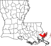 | |
| Other communities | ||
| Ghost towns | ||
- Articles with short description
- Short description is different from Wikidata
- Use mdy dates from July 2023
- Coordinates on Wikidata
- Commons category link from Wikidata
- Articles with NARA identifiers
- Census-designated places in St. Bernard Parish, Louisiana
- Census-designated places in Louisiana
- Census-designated places in New Orleans metropolitan area
- Louisiana populated places on the Mississippi River