User:Ken g6/Sandbox
Jump to navigation
Jump to search
| This is a Wikipedia user page. This is not an encyclopedia article or the talk page for an encyclopedia article. If you find this page on any site other than Wikipedia, you are viewing a mirror site. Be aware that the page may be outdated and that the user in whose space this page is located may have no personal affiliation with any site other than Wikipedia. The original page is located at https://en.wikipedia.org/wiki/User:Ken_g6/Sandbox. |
City of Longmont | |
|---|---|
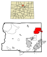
 Location in Boulder County and the state of Colorado | |
| Coordinates: 40°10′18″N 105°6′33″W / 40.17167°N 105.10917°W | |
| Country | |
| State | |
| Counties[1] | Boulder, Weld |
| Founded | 1871 |
| Incorporated | November 15, 1885[2] |
| Government | |
| • Type | Home Rule Municipality[1] |
| • Mayor | Roger Lange List of Mayors |
| Area | |
| • Total | 56.4 km2 (21.8 sq mi) |
| • Land | 56.4 km2 (21.8 sq mi) |
| • Water | 0 km2 (0 sq mi) |
| Elevation | 1,519 m (4,984 ft) |
| Population (2000) | |
| • Total | 71,093 |
| • Density | 1,260.5/km2 (3,261.1/sq mi) |
| Time zone | UTC-7 (Mountain (MST)) |
| • Summer (DST) | UTC-6 (MDT) |
| ZIP codes[4] | 80501-80504 |
| Area code(s) | 303, 720 |
| FIPS code | 08-45970 |
| GNIS feature ID | 0202560 |
| Website | http://www.ci.longmont.co.us |
References
The reference should appear here:
- ^ a b "Active Colorado Municipalities" (HTML). State of Colorado, Department of Local Affairs. Retrieved 2007-09-01.
- ^ "Colorado Municipal Incorporations" (HTML). State of Colorado, Department of Personnel & Administration, Colorado State Archives. 2004-12-01. Retrieved 2007-09-02.
{{cite web}}: Check date values in:|date=(help) - ^ "US Board on Geographic Names". United States Geological Survey. 2007-10-25. Retrieved 2008-01-31.
- ^ "ZIP Code Lookup" (JavaScript/HTML). United States Postal Service. Retrieved November 15, 2007.
Flags
Date
Today is 2008-01-02