Tiszasas
Tiszasas | |
|---|---|
Village | |
| Coordinates: 46°49′23″N 20°04′48″E / 46.82306°N 20.08000°E | |
| Country | |
| County | Jász-Nagykun-Szolnok |
| District | Kunszentmárton |
| Area | |
| • Total | 28.79 km2 (11.12 sq mi) |
| Population (2015) | |
| • Total | 1,023[1] |
| • Density | 35.5/km2 (92/sq mi) |
| Time zone | UTC+1 (CET) |
| • Summer (DST) | UTC+2 (CEST) |
| Postal code | 5474 |
| Area code(s) | (+36) 56 |
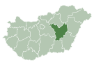
Tiszasas is a village in Jász-Nagykun-Szolnok county, in the Northern Great Plain region of central Hungary. It is near the river Tisza, where people like to go fishing. It has a church near the river. Trains go from Budapest to Tiszasas or from Budapest to Szolnok and from there to Tiszasas. It takes 1 hour and 50 minutes via car from Budapest to Tiszasas.
History
Not much is known about its history. It was first mentioned in the year 1348. According to brief sources, it was first a settlement sometime in 700. In some parts of the village, they believe in an alternate history called the Zalanic mythology. Their beliefs say Zalan I (c. 700-723) was the first "king" of Tiszasas.
Geography
It covers an area of 28.79 km2 (11 sq mi) and has a population of 1023 people (2015).[1]

References
- ^ a b Gazetteer of Hungary, 1 January 2015. Hungarian Central Statistical Office. 3 September 2015
External links
- Official site in Hungarian


