Stokes Field
Jump to navigation
Jump to search
| Stokes Field | |
|---|---|
 | |
 | |
| Type | Local Nature Reserve |
| Location | Long Ditton, Surrey |
| OS grid | SU 854 498 |
| Area | 5.9 hectares (15 acres) |
| Managed by | Elmbridge Borough Council |
Stokes Field is a 5.9-hectare (15-acre) Local Nature Reserve in Long Ditton in Surrey. It is owned and managed by Elmbridge Borough Council.[1][2]
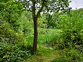
The field has diverse habitats with a pond, scrubland, woodland and grassland. Flora include crab apple trees, cuckoo flowers, pyramidal orchid,[1] blackberries, and rosehip.
There is access from Sugden Road.
Gallery
-
 A grassy area in Stokes Field
 -
 A pond in Stokes Field
 -
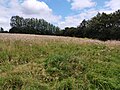 A hill in Stokes Field


References
- ^ a b "Stokes Field". Local Nature Reserves. Natural England. Retrieved 28 November 2018.
- ^ "Map of Stokes Field". Local Nature Reserves. Natural England. Retrieved 28 November 2018.