Samburg, Tennessee
Samburg, Tennessee | |
|---|---|
 Buildings along Lakeview Drive, with Reelfoot Lake on the left | |
 Location of Samburg in Obion County, Tennessee. | |
| Coordinates: 36°22′48″N 89°21′8″W / 36.38000°N 89.35222°W | |
| Country | United States |
| State | Tennessee |
| County | Obion |
| Government | |
| • Mayor | John Glessner |
| Area | |
| • Total | 0.69 sq mi (1.80 km2) |
| • Land | 0.47 sq mi (1.23 km2) |
| • Water | 0.22 sq mi (0.58 km2) |
| Elevation | 285 ft (87 m) |
| Population | |
| • Total | 210 |
| • Density | 443.97/sq mi (171.29/km2) |
| Time zone | UTC-6 (Central (CST)) |
| • Summer (DST) | UTC-5 (CDT) |
| ZIP code | 38254 |
| Area code | 731 |
| FIPS code | 47-66360[4] |
| GNIS feature ID | 1300630[2] |
Samburg is a town in Obion County, Tennessee, United States. The population was 210 at the 2020 census.[5] Samburg is located on the eastern shores of Reelfoot Lake.
On the night of December 10 and morning of December 11, 2021 a devastating tornado destroyed much of the town.[6]
Geography
Samburg is located at 36°22′48″N 89°21′8″W / 36.38000°N 89.35222°W (36.379990, -89.352253).[7]
According to the United States Census Bureau, the town has a total area of 0.8 square miles (2.1 km2), of which 0.6 square miles (1.6 km2) is land and 0.2 square miles (0.52 km2) (26.51%) is water.
Climate
| Climate data for Samburg, Tennessee (1991–2020 normals, extremes 1928–present) | |||||||||||||
|---|---|---|---|---|---|---|---|---|---|---|---|---|---|
| Month | Jan | Feb | Mar | Apr | May | Jun | Jul | Aug | Sep | Oct | Nov | Dec | Year |
| Record high °F (°C) | 78 (26) |
79 (26) |
89 (32) |
96 (36) |
100 (38) |
106 (41) |
110 (43) |
111 (44) |
104 (40) |
99 (37) |
86 (30) |
79 (26) |
111 (44) |
| Mean daily maximum °F (°C) | 43.9 (6.6) |
49.0 (9.4) |
58.6 (14.8) |
69.1 (20.6) |
76.9 (24.9) |
84.6 (29.2) |
87.0 (30.6) |
86.6 (30.3) |
81.2 (27.3) |
71.3 (21.8) |
58.5 (14.7) |
48.0 (8.9) |
67.9 (19.9) |
| Daily mean °F (°C) | 35.2 (1.8) |
39.4 (4.1) |
48.5 (9.2) |
58.1 (14.5) |
66.9 (19.4) |
75.0 (23.9) |
77.6 (25.3) |
76.4 (24.7) |
69.9 (21.1) |
58.9 (14.9) |
48.4 (9.1) |
39.1 (3.9) |
57.8 (14.3) |
| Mean daily minimum °F (°C) | 26.5 (−3.1) |
29.8 (−1.2) |
38.4 (3.6) |
47.1 (8.4) |
56.9 (13.8) |
65.3 (18.5) |
68.3 (20.2) |
66.2 (19.0) |
58.6 (14.8) |
46.5 (8.1) |
38.3 (3.5) |
30.3 (−0.9) |
47.7 (8.7) |
| Record low °F (°C) | −15 (−26) |
−17 (−27) |
7 (−14) |
22 (−6) |
33 (1) |
41 (5) |
45 (7) |
46 (8) |
34 (1) |
23 (−5) |
5 (−15) |
−12 (−24) |
−17 (−27) |
| Average precipitation inches (mm) | 4.48 (114) |
4.22 (107) |
4.95 (126) |
5.28 (134) |
5.72 (145) |
4.24 (108) |
3.91 (99) |
3.27 (83) |
3.85 (98) |
3.92 (100) |
4.27 (108) |
5.06 (129) |
53.17 (1,351) |
| Source: NOAA[8][9] | |||||||||||||
Demographics
| Census | Pop. | Note | %± |
|---|---|---|---|
| 1910 | 111 | — | |
| 1950 | 378 | — | |
| 1960 | 451 | 19.3% | |
| 1970 | 463 | 2.7% | |
| 1980 | 465 | 0.4% | |
| 1990 | 374 | −19.6% | |
| 2000 | 260 | −30.5% | |
| 2010 | 217 | −16.5% | |
| 2020 | 210 | −3.2% | |
| Sources:[10][11][3] | |||
Samburg is part of the Union City, TN–KY Micropolitan Statistical Area.
As of the census[4] of 2000, there were 260 people, 104 households, and 69 families residing in the town. The population density was 428.2 inhabitants per square mile (165.3/km2). There were 161 housing units at an average density of 265.2 per square mile (102.4/km2). The racial makeup of the town was 99.62% White, and 0.38% from two or more races. Hispanic or Latino of any race were 1.15% of the population.
There were 104 households, out of which 27.9% had children under the age of 18 living with them, 50.0% were married couples living together, 10.6% had a female householder with no husband present, and 32.7% were non-families. 23.1% of all households were made up of individuals, and 16.3% had someone living alone who was 65 years of age or older. The average household size was 2.49 and the average family size was 2.87.
In the town, the population was spread out, with 21.2% under the age of 18, 5.8% from 18 to 24, 30.0% from 25 to 44, 24.2% from 45 to 64, and 18.8% who were 65 years of age or older. The median age was 42 years. For every 100 females there were 108.0 males. For every 100 females age 18 and over, there were 107.1 males.
The median income for a household in the town was $26,125, and the median income for a family was $29,167. Males had a median income of $24,583 versus $16,458 for females. The per capita income for the town was $14,162. About 8.3% of families and 13.4% of the population were below the poverty line, including 15.4% of those under the age of eighteen and 15.2% of those 65 or over.
Media
Radio Stations
- WENK-AM 1240 - "The Greatest Hits of All Time"
- WWGY 99.3 - "Today's Best Music with Ace & TJ in the Morning"
References
- ^ "ArcGIS REST Services Directory". United States Census Bureau. Retrieved October 15, 2022.
- ^ a b U.S. Geological Survey Geographic Names Information System: Samburg, Tennessee
- ^ a b "Census Population API". United States Census Bureau. Retrieved Oct 15, 2022.
- ^ a b "U.S. Census website". United States Census Bureau. Retrieved 2008-01-31.
- ^ "Explore Census Data". data.census.gov. Retrieved 2021-12-12.
- ^ "Deadly tornado causes destruction in Obion and Dyer counties". 11 December 2021.
- ^ "US Gazetteer files: 2010, 2000, and 1990". United States Census Bureau. 2011-02-12. Retrieved 2011-04-23.
- ^ "NowData - NOAA Online Weather Data". National Oceanic and Atmospheric Administration. Retrieved September 25, 2021.
- ^ "Station: Samburg WR, TN". U.S. Climate Normals 2020: U.S. Monthly Climate Normals (1991-2020). National Oceanic and Atmospheric Administration. Retrieved September 25, 2021.
- ^ "Census of Population and Housing: Decennial Censuses". United States Census Bureau. Retrieved 2012-03-04.
- ^ "Incorporated Places and Minor Civil Divisions Datasets: Subcounty Resident Population Estimates: April 1, 2010 to July 1, 2012". Population Estimates. U.S. Census Bureau. Archived from the original on 11 June 2013. Retrieved 11 December 2013.
Municipalities and communities of Obion County, Tennessee, United States | ||
|---|---|---|
| Cities | 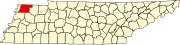 | |
| Towns | ||
| Unincorporated communities | ||
| Footnotes | ‡This populated place also has portions in an adjacent county or counties | |
| International | |
|---|---|
| National | |