Rowletts, Kentucky
Jump to navigation
Jump to search
Rowletts, Kentucky | |
|---|---|
 Rowletts  Rowletts | |
| Coordinates: 37°14′27″N 85°53′39″W / 37.24083°N 85.89417°W | |
| Country | United States |
| State | Kentucky |
| County | Hart |
| Elevation | 673 ft (205 m) |
| Time zone | UTC-6 (Central (CST)) |
| • Summer (DST) | UTC-5 (CDT) |
| Area code(s) | 270 & 364 |
| GNIS feature ID | 495517[1] |
Rowletts is an unincorporated community in Hart County, Kentucky, in the United States.[1]
History
Rowletts was a station on the railroad.[2] A post office called Rowlett's Depot was established in 1860, was renamed Rowletts in 1880, and remained in operation until it was discontinued in 1995.[3] The community was named for John W. Rowlett, a railroad official.[4]
References
- ^ a b U.S. Geological Survey Geographic Names Information System: Rowletts, Kentucky
- ^ Collins, Lewis (1877). History of Kentucky. p. 332.
- ^ "Hart County". Jim Forte Postal History. Retrieved January 11, 2015.
- ^ Rennick, Robert M. Kentucky Place Names. University Press of Kentucky. p. 257. ISBN 0-8131-2631-2.
Municipalities and communities of Hart County, Kentucky, United States | ||
|---|---|---|
| Cities | 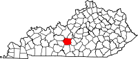 | |
| CDP | ||
| Other unincorporated communities | ||
This Hart County, Kentucky state location article is a stub. You can help Wikipedia by expanding it. |
Categories:
- Articles with short description
- Short description is different from Wikidata
- Use mdy dates from July 2023
- Coordinates on Wikidata
- Pages using infobox settlement with possible area code list
- Unincorporated communities in Hart County, Kentucky
- Unincorporated communities in Kentucky
- All stub articles
- Kentucky geography stubs