Prairie Elk Colony, Montana
Jump to navigation
Jump to search
Prairie Elk Colony, Montana | |
|---|---|
 Prairie Elk Colony  Prairie Elk Colony | |
| Coordinates: 48°0′51″N 105°47′49″W / 48.01417°N 105.79694°W | |
| Country | United States |
| State | Montana |
| County | McCone |
| Area | |
| • Total | 0.35 sq mi (0.90 km2) |
| • Land | 0.35 sq mi (0.90 km2) |
| • Water | 0.00 sq mi (0.00 km2) |
| Elevation | 2,040 ft (620 m) |
| Population | |
| • Total | 0 |
| • Density | 0.00/sq mi (0.00/km2) |
| Time zone | UTC-7 (Mountain (MST)) |
| • Summer (DST) | UTC-6 (MDT) |
| ZIP Code | 59201 (Wolf Point) |
| Area code | 406 |
| FIPS code | 30-59650 |
| GNIS feature ID | 2806640[3] |
Prairie Elk Colony is a Hutterite community[4] and census-designated place (CDP) in McCone County, Montana, United States. It is on the northern edge of the county, just south of the Missouri River, which forms the county line. By road it is 20 miles (32 km) southwest of Wolf Point, the nearest town.
The community was first listed as a CDP for the 2020 census,[3] at which time the population was recorded as 0.[2]
| Census | Pop. | Note | %± |
|---|---|---|---|
| 2020 | 0 | — | |
| U.S. Decennial Census[5] | |||
References
- ^ "2023 U.S. Gazetteer Files: Montana". United States Census Bureau. Retrieved May 17, 2024.
- ^ a b "P1. Race – Prairie Elk Colony CDP, Montana: 2020 DEC Redistricting Data (PL 94-171)". U.S. Census Bureau. Retrieved May 17, 2024.
- ^ a b "Prairie Elk Colony Census Designated Place". Geographic Names Information System. United States Geological Survey, United States Department of the Interior.
- ^ Morton, Claudette, ed. (2010). Essential Understandings of Montana Hutterites: A Resource for Educators and Students (PDF). Montana Office of Public Instruction. p. 2. Retrieved June 11, 2021.
- ^ "Census of Population and Housing". Census.gov. Retrieved June 4, 2016.
Municipalities and communities of McCone County, Montana, United States | ||
|---|---|---|
| Town | 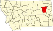 | |
| CDPs | ||
| Indian reservation | ||
| Footnotes | ‡This populated place also has portions in an adjacent county or counties | |
This McCone County, Montana state location article is a stub. You can help Wikipedia by expanding it. |