Peterson, Alabama
Jump to navigation
Jump to search
Peterson, Alabama | |
|---|---|
 Peterson, Alabama  Peterson, Alabama | |
| Coordinates: 33°13′57″N 87°25′25″W / 33.23250°N 87.42361°W | |
| Country | United States |
| State | Alabama |
| County | Tuscaloosa |
| Elevation | 417 ft (127 m) |
| Time zone | UTC-6 (Central (CST)) |
| • Summer (DST) | UTC-5 (CDT) |
| ZIP code | 35478 |
| Area code(s) | 205, 659 |
| GNIS feature ID | 152878[1] |
Peterson is an unincorporated community in Tuscaloosa County, Alabama, United States. Peterson is located on Alabama State Route 216, 8.6 miles (13.8 km) east-northeast of Tuscaloosa.[2] Peterson has a post office with ZIP code 35478.[3] Peterson was originally known as Peterson City, in honor of Charles M. Peterson, who purchased land in the surrounding area.[4]
References
- ^ "Peterson". Geographic Names Information System. United States Geological Survey, United States Department of the Interior.
- ^ Tuscaloosa County, Alabama (PDF) (Map). Alabama Department of Transportation. 2008. Retrieved March 12, 2012.[permanent dead link]
- ^ United States Postal Service (2012). "USPS - Look Up a ZIP Code". Retrieved February 15, 2012.
- ^ Foscue, Virginia (1989). Place Names in Alabama. Tuscaloosa: The University of Alabama Press. p. 109. ISBN 0-8173-0410-X.
Municipalities and communities of Tuscaloosa County, Alabama, United States | ||
|---|---|---|
| Cities | 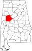 | |
| Towns | ||
| CDPs | ||
| Other unincorporated communities | ||
| Ghost town | ||
| Footnotes | ‡This populated place also has portions in an adjacent county or counties | |
This Tuscaloosa County, Alabama state location article is a stub. You can help Wikipedia by expanding it. |
Categories:
- All articles with dead external links
- Articles with dead external links from March 2018
- Articles with permanently dead external links
- Use mdy dates from July 2023
- Articles with short description
- Short description is different from Wikidata
- Coordinates on Wikidata
- Pages using infobox settlement with possible area code list
- Unincorporated communities in Tuscaloosa County, Alabama
- Unincorporated communities in Alabama
- All stub articles
- Central Alabama geography stubs