Oderwald
Jump to navigation
Jump to search
This article needs additional citations for verification. (September 2021) |
Oderwald | |
|---|---|
 Coat of arms | |
Location of Oderwald within Wolfenbüttel district 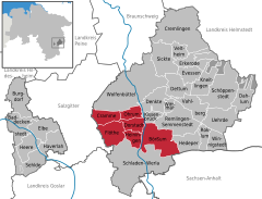 | |
 Oderwald  Oderwald | |
| Coordinates: 52°04′N 10°35′E / 52.067°N 10.583°E | |
| Country | Germany |
| State | Lower Saxony |
| District | Wolfenbüttel |
| Subdivisions | 6 municipalities |
| Area | |
| • Total | 89.04 km2 (34.38 sq mi) |
| Population (2022-12-31)[1] | |
| • Total | 6,758 |
| • Density | 76/km2 (200/sq mi) |
| Time zone | UTC+01:00 (CET) |
| • Summer (DST) | UTC+02:00 (CEST) |
| Vehicle registration | WF |
| Website | www |
Oderwald is a Samtgemeinde ("collective municipality") in the district of Wolfenbüttel, in Lower Saxony, Germany. It is situated along the river Oker, approx. 10 km south of Wolfenbüttel. It is named after the Oderwald, a small chain of hills in the municipality. Its seat is in the village Börßum.
The Samtgemeinde Oderwald consists of the following municipalities:
References
| International | |
|---|---|
| National | |
This Wolfenbüttel district location article is a stub. You can help Wikipedia by expanding it. |
Categories:
- Pages using gadget WikiMiniAtlas
- CS1 German-language sources (de)
- Articles needing additional references from September 2021
- All articles needing additional references
- Articles with short description
- Short description is different from Wikidata
- Coordinates on Wikidata
- Samtgemeinden in Lower Saxony
- Articles with VIAF identifiers
- Articles with WorldCat Entities identifiers
- Articles with GND identifiers
- All stub articles
- Braunschweig region geography stubs