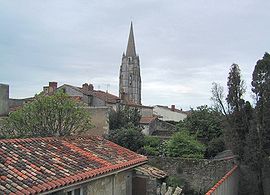
Marennes, Charente-Maritime
Jump to navigation
Jump to search
You can help expand this article with text translated from the corresponding article in French. (December 2008) Click [show] for important translation instructions.
|
Marennes | |
|---|---|
Part of Marennes-Hiers-Brouage | |
 | |
| Coordinates: 45°49′21″N 1°06′19″W / 45.8225°N 1.1052°W | |
| Country | France |
| Region | Nouvelle-Aquitaine |
| Department | Charente-Maritime |
| Arrondissement | Rochefort |
| Canton | Marennes |
| Commune | Marennes-Hiers-Brouage |
| Area 1 | 20.09 km2 (7.76 sq mi) |
| Population (2019)[1] | 5,628 |
| • Density | 280/km2 (730/sq mi) |
| Time zone | UTC+01:00 (CET) |
| • Summer (DST) | UTC+02:00 (CEST) |
| Postal code | 17320 |
| Elevation | 0–21 m (0–69 ft) |
| 1 French Land Register data, which excludes lakes, ponds, glaciers > 1 km2 (0.386 sq mi or 247 acres) and river estuaries. | |
Marennes (French pronunciation: [maʁɛn]) is a former commune in the Charente-Maritime department, southwestern France. On 1 January 2019, it was merged into the new commune Marennes-Hiers-Brouage.[2]
History
For a long time it was one of the most prosperous cities of the Saintonge due to its location in the middle of the salt-water marshes at a time where salt was a valuable commodity. Marennes is a center for oyster farming.
Population
|
|
References
- ^ Téléchargement du fichier d'ensemble des populations légales en 2019, INSEE
- ^ Arrêté préfectoral 27 November 2018 (in French)
External links
Wikimedia Commons has media related to Marennes (Charente-Maritime).
Categories:
- Articles with French-language sources (fr)
- Geography articles needing translation from French Wikipedia
- Articles with short description
- Short description is different from Wikidata
- Coordinates on Wikidata
- Pages using infobox settlement with image map1 but not image map
- Pages with French IPA
- Commons category link is on Wikidata
- Articles with VIAF identifiers
- Articles with BNF identifiers
- Articles with BNFdata identifiers
- Articles with GND identifiers
- Articles with SUDOC identifiers
- Former communes of Charente-Maritime
- Charente-Maritime communes articles needing translation from French Wikipedia
- Populated places disestablished in 2019
- All stub articles
- Charente-Maritime geography stubs
- County of Saintonge
- Pages using the Kartographer extension


