Lisserbroek
Jump to navigation
Jump to search
Lisserbroek | |
|---|---|
Village | |
 | |
 Lisserbroek Location in the Netherlands  Lisserbroek Location in the province of North Holland in the Netherlands | |
| Coordinates: 52°15′N 4°34′E / 52.250°N 4.567°E | |
| Country | Netherlands |
| Province | North Holland |
| Municipality | Haarlemmermeer |
| Area | |
| • Total | 5.92 km2 (2.29 sq mi) |
| Elevation | −1.9 m (−6.2 ft) |
| Population (2021)[1] | |
| • Total | 3,435 |
| • Density | 580/km2 (1,500/sq mi) |
| Time zone | UTC+1 (CET) |
| • Summer (DST) | UTC+2 (CEST) |
| Postal code | 2165[1] |
| Dialing code | 0252 |
Lisserbroek is a village in the Dutch province of North Holland. It is a part of the municipality of Haarlemmermeer, and lies about 10 km southwest of Hoofddorp. It is located along the Ringvaart opposite the town of Lisse in the area called the "Dune and Bulb Region" (Duin- en Bollenstreek).
The village was first mentioned between 1280 and 1287 as "lisse inden broke", and means "swampy land near Lisse.[3]
Gallery
-
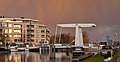 Night view of the bridge in Lisserbroek
.jpg)
References
- ^ a b c "Kerncijfers wijken en buurten 2021". Central Bureau of Statistics. Retrieved 30 April 2022.
- ^ "Postcodetool for 2165AA". Actueel Hoogtebestand Nederland (in Dutch). Het Waterschapshuis. Retrieved 30 April 2022.
- ^ "Lisserbroek - (geografische naam)". Etymologiebank (in Dutch). Retrieved 30 April 2022.
Wikimedia Commons has media related to Lisserbroek.
This North Holland location article is a stub. You can help Wikipedia by expanding it. |
Categories:
- Pages using gadget WikiMiniAtlas
- Pages with non-numeric formatnum arguments
- CS1 Dutch-language sources (nl)
- Articles with short description
- Short description is different from Wikidata
- Coordinates on Wikidata
- Commons category link from Wikidata
- Populated places in North Holland
- Haarlemmermeer
- All stub articles
- North Holland geography stubs