Le Moyen, Louisiana
Jump to navigation
Jump to search
Le Moyen, Louisiana | |
|---|---|
 Le Moyen, Louisiana  Le Moyen, Louisiana | |
| Coordinates: 30°47′08″N 92°02′25″W / 30.78556°N 92.04028°W | |
| Country | United States |
| State | Louisiana |
| Parish | St. Landry |
| Elevation | 39 ft (12 m) |
| Time zone | UTC-6 (Central (CST)) |
| • Summer (DST) | UTC-5 (CDT) |
| ZIP code | 71356 |
| Area code | 337 |
| GNIS feature ID | 1627460[1] |
Le Moyen (also LeMoyen, Lemoyen) is an unincorporated community in St. Landry Parish, Louisiana, United States.[1] Its ZIP Code is 71356.[2]
Notes
- ^ a b "Le Moyen, Louisiana". Geographic Names Information System. United States Geological Survey, United States Department of the Interior.
- ^ United States Postal Service (2012). "USPS - Look Up a ZIP Code". Retrieved February 15, 2012.
Municipalities and communities of St. Landry Parish, Louisiana, United States | ||
|---|---|---|
| Cities | 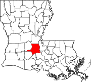 | |
| Towns | ||
| Villages | ||
| CDPs | ||
| Other communities | ||
| Footnotes | ‡This populated place also has portions in an adjacent parish or parishes | |
This Louisiana state location article is a stub. You can help Wikipedia by expanding it. |