Kurowo Braniewskie
Jump to navigation
Jump to search
Kurowo Braniewskie | |
|---|---|
Village | |
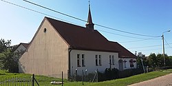
 Chapel in Kurowo | |
| Coordinates: 54°13′39″N 19°44′58″E / 54.22750°N 19.74944°E | |
| Country | |
| Voivodeship | Warmian-Masurian |
| County | Elbląg |
| Gmina | Młynary |
Kurowo Braniewskie [kuˈrɔvɔ braˈɲɛfskʲɛ] is a village in the administrative district of Gmina Młynary, within Elbląg County, Warmian-Masurian Voivodeship, in northern Poland.[1]
Before 1772 the area was part of Kingdom of Poland, and in 1772–1945 it belonged to Prussia and Germany (East Prussia).
References

