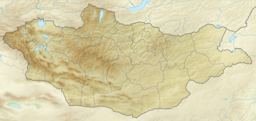
Khurgan Lake
Jump to navigation
Jump to search
| Khurgan Lake | |
|---|---|
 View of lake taken during ISS Expedition 28 | |
| Location | Bayan-Ölgii Province, Mongolia |
| Coordinates | 48°32′46″N 88°36′22″E / 48.54611°N 88.60611°E |
| Primary inflows | Khovd River |
| Basin countries | Mongolia |
| Max. length | 23.3 km (14.5 mi) |
| Max. width | 6 km (3.7 mi) |
| Surface area | 71 km2 (27 sq mi) |
| Average depth | 7.8 m (26 ft) |
| Max. depth | 28 m (92 ft) |
| Water volume | 0.537 km3 (435,000 acre⋅ft) |
| Surface elevation | 2,072 m (6,798 ft) |
Khurgan Lake (Mongolian: Хурган нуур) is a lake located in the district of Tsengel, in the Bayan-Ölgii Province of western Mongolia.
The lake is connected to Khoton Lake by a wide and short channel (about 2 km (1 mi)); both, together with the Dayan Lake, feed the Khovd River.[1] Khurgan Lake is located within the Altai Tavan Bogd National Park.[2]
Climate
The climate is cold.[3] The average temperature is -4 °C. The warmest month is July, at 14 °C, and the coldest is December, at -24 °C.[4] The average rainfall is 278 millimeters per year. The wettest month is July, with 55 millimeters of rain, and the wettest is February, with 6 millimeters.[5]
References
- ^ Khoton and Khurgan lakes
- ^ Altaj Tavan Bogd Archived 18 June 2011 at the Wayback Machine
- ^ Peel, M C; Finlayson, B L (2007). "Updated world map of the Köppen-Geiger climate classification". Hydrology and Earth System Sciences. 11 (5): 1633–1644. doi:10.5194/hess-11-1633-2007. Retrieved 30 January 2016.
- ^ "NASA Earth Observations Data Set Index". NASA. Archived from the original on 6 August 2013. Retrieved 30 January 2016.
- ^ "NASA Earth Observations: Rainfall (1 month - TRMM)". NASA/Tropical Rainfall Monitoring Mission. Archived from the original on 13 April 2020. Retrieved 30 January 2016.
Categories:
- Webarchive template wayback links
- Articles with short description
- Short description is different from Wikidata
- Coordinates on Wikidata
- Articles using infobox body of water without alt
- Articles using infobox body of water without pushpin map alt
- Articles using infobox body of water without image bathymetry
- Articles containing Mongolian-language text
- Lakes of Mongolia
- Landforms of Bayan-Ölgii Province
- All stub articles
- Mongolia geography stubs
- Lake stubs
