Kanawha Falls, West Virginia
Jump to navigation
Jump to search
Kanawha Falls, West Virginia | |
|---|---|
 Kanawha Falls  Kanawha Falls | |
| Coordinates: 38°08′33″N 81°12′23″W / 38.14250°N 81.20639°W | |
| Country | United States |
| State | West Virginia |
| County | Fayette |
| Elevation | 659 ft (201 m) |
| Time zone | UTC-5 (Eastern (EST)) |
| • Summer (DST) | UTC-4 (EDT) |
| ZIP code | 25115[1] |
| Area code(s) | 304 & 681 |
| GNIS feature ID | 1554842[2] |
Kanawha Falls is an unincorporated community in Fayette County, West Virginia, United States. Kanawha Falls is located on the east bank of the Kanawha River, 2 miles (3.2 km) southwest of Gauley Bridge and 0.6 miles (0.97 km) downstream from the waterfall of the same name. Kanawha Falls had a post office, which opened on March 26, 1856, and closed on November 2, 2002.[3]
Gallery
-
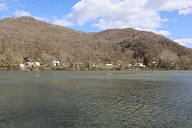 Kanawha Falls in 2022
 -
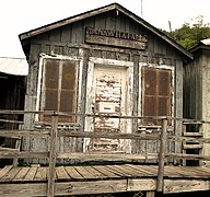 Kanawha Falls Post Office in 2015
 -
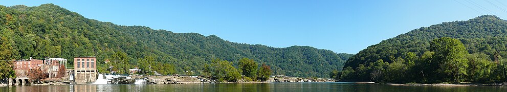 Kanawha Falls on the Kanawha River at Glen Ferris, WV


References
Wikimedia Commons has media related to Kanawha Falls, West Virginia.
- ^ United States Postal Service (2012). "USPS - Look Up a ZIP Code". Retrieved February 15, 2012.
- ^ U.S. Geological Survey Geographic Names Information System: Kanawha Falls, West Virginia
- ^ "Postmaster Finder - Post Offices by ZIP Code". United States Postal Service. Retrieved September 26, 2011.

This article about a location in Fayette County, West Virginia is a stub. You can help Wikipedia by expanding it. |
Categories:
- Use mdy dates from July 2023
- Articles with short description
- Short description is different from Wikidata
- Coordinates on Wikidata
- Pages using infobox settlement with possible area code list
- Commons category link is on Wikidata
- Unincorporated communities in Fayette County, West Virginia
- Unincorporated communities in West Virginia
- Populated places on the Kanawha River
- West Virginia placenames of Native American origin
- All stub articles
- Fayette County, West Virginia geography stubs