Ilići
Jump to navigation
Jump to search
Ilići | |
|---|---|
 Ilići and river Radobolja in Mostar | |
 Ilići | |
| Coordinates: 43°20′50″N 17°46′05″E / 43.3472°N 17.7681°E | |
| Country | Bosnia and Herzegovina |
| Entity | Federation of Bosnia and Herzegovina |
| Canton | Herzegovina-Neretva |
| Municipality | City of Mostar |
| Area | |
| • Total | 3.49 sq mi (9.05 km2) |
| Elevation | 300 ft (90 m) |
| Population (2013) | |
| • Total | 2,585 |
| • Density | 740/sq mi (290/km2) |
| Time zone | UTC+1 (CET) |
| • Summer (DST) | UTC+2 (CEST) |
Ilići is a suburban neighborhood of Mostar, Bosnia and Herzegovina, centered on the main strip of Ilićka Street immediately west of downtown and extending until the spring of Radobolja river.
Ilići is located at 43.3472 N, 17.7681 E, at an average elevation of 90 metres.
Demographics
According to the 2013 census, its population was 2,585.[1]
| Ethnicity | Number | Percentage |
|---|---|---|
| Croats | 2,497 | 96.6% |
| Bosniaks | 62 | 2.4% |
| Serbs | 4 | 0.2% |
| other/undeclared | 22 | 0.9% |
| Total | 2,585 | 100% |
Gallery
-
 Radobolja river in Ilići, Mostar
 -
 Virgin Mary statue in Ilići, Mostar
 -
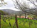 Orchard in Ilići, Mostar


References
- ^ "Naseljena Mjesta 1991/2013" (in Croatian). Statistical Office of Bosnia and Herzegovina. Retrieved October 9, 2021.
This Herzegovina-Neretva Canton geography article is a stub. You can help Wikipedia by expanding it. |
Categories:
- Pages using gadget WikiMiniAtlas
- CS1 Croatian-language sources (hr)
- Articles with short description
- Short description is different from Wikidata
- Coordinates on Wikidata
- Populated places in Mostar
- Villages in the Federation of Bosnia and Herzegovina
- All stub articles
- Herzegovina-Neretva Canton geography stubs