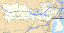
Hog's Hole
| Site of Special Scientific Interest | |
 | |
| Location | Berkshire |
|---|---|
| Grid reference | SU 378 597[1] |
| Coordinates | 51°20′02″N 1°27′32″W / 51.334°N 1.459°W |
| Interest | Biological |
| Area | 23.7 hectares (59 acres)[1] |
| Notification | 1988[1] |
| Location map | Magic Map |
Hog's Hole is a 23.7-hectare (59-acre) biological Site of Special Scientific Interest in the civil parish of Combe in the English county of Berkshire.[1][2]
Geography
Hog's Hole is one of three nationally important chalk grassland sites that lie within the North Wessex Downs along with Rushmore and Conholt Downs (SSSI) and part of Inkpen and Walbury Hills (SSSI).[3]
Hog's Hole consists of a dry valley, or combe, cut in the Middle and Upper Chalk. The steep east and west-facing valley sides support only thin rendzina soils, an unusual feature being lines of bare chalk and flint scree. The valley opens out in its southern part, the remainder of the site consisting of a moderately steep and undulating south-facing slope and a steep west-facing slope rising to a plateau area.[4]
History
The site has been predominantly used for grazing sheep.[4]
Fauna
The site has the following Fauna:[4]
Birds
Flora
The site has the following Flora:[4]
Trees
Plants
- Festuca ovina
- Avenula pratensis
- Cirsium acaule
- Asperula cynanchica
- Festuca rubra
- Briza media
- Koeleria macrantha
- Avenula pubescens
- Holcus lanatus
- Trisetum flavescens
- Carex flacca
- Hieracium pilosella
- Leontodon hispidus
- Galium verum
- Clinopodium vulgare
- Common eyebright
- Sanguisorba minor
- Polygala vulgaris
- Plantago media
- Hippocrepis comosa
- Helianthemum nummularium
- Ranunculus bulbosus
- Viola hirta
- Gentianella amarella
- Carduus nutans
- Dactylorhiza fuchsii
- Carex caryophyllea
- Thymus praecox
- Thymus pulegioides
- Linum catharticum
- Arenaria serpyllifolia
- Silene dioica
- Geum urbanum
- Geranium robertianum
- Circaea lutetiana
- Bromus erectus
- Arrhenatherum elatius
- Lolium perenne
- Trifolium repens
- Urtica dioica
References
- ^ a b c d "Designated Sites View: Hog's Hole". Sites of Special Scientific Interest. Natural England. Retrieved 17 October 2019.
- ^ "Map of Hog's Hole". Sites of Special Scientific Interest. Natural England. Retrieved 17 October 2019.
- ^ "LUC Standard Report Template-London" (PDF). Retrieved 5 February 2017.
- ^ a b c d "Hog's Hole citation" (PDF). Sites of Special Scientific Interest. Natural England. Retrieved 17 October 2019.
