Gmina Pietrowice Wielkie
Gmina Pietrowice Wielkie
Pietrowice Wielkie Commune | |
|---|---|
 Chapell in Lekartów | |
 Flag  Coat of arms | |
| Coordinates (Pietrowice Wielkie): 50°5′6″N 18°5′1″E / 50.08500°N 18.08361°E | |
| Country | |
| Voivodeship | Silesian |
| County | Racibórz |
| Seat | Pietrowice Wielkie |
| Area | |
| • Total | 68.07 km2 (26.28 sq mi) |
| Population (2019-06-30[1]) | |
| • Total | 6,908 |
| • Density | 100/km2 (260/sq mi) |
| Website | http://www.pietrowicewielkie.com.pl |
Gmina Pietrowice Wielkie is a rural gmina (administrative district) in Racibórz County, Silesian Voivodeship, in southern Poland, on the Czech border. Its seat is the village of Pietrowice Wielkie, which lies approximately 11 kilometres (7 mi) west of Racibórz and 68 km (42 mi) west of the regional capital Katowice.
The gmina covers an area of 68.07 square kilometres (26.3 sq mi), and as of 2019 its total population is 6,908.
Villages
Gmina Pietrowice Wielkie contains the villages and settlements of Amandów, Cyprzanów, Gródczanki, Kornice, Krowiarki, Lekartów, Maków, Pawłów, Pietrowice Wielkie, Samborowice and Żerdziny.
Neighbouring gminas
Gmina Pietrowice Wielkie is bordered by the town of Racibórz and by the gminas of Baborów, Kietrz, Krzanowice and Rudnik. It also borders the Czech Republic.
Twin towns – sister cities
Gmina Pietrowice Wielkie is twinned with:[2]
 Liederbach am Taunus, Germany
 Sudice, Czech Republic
Gallery
-
 Memorial in Cyprzanów
 -
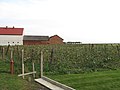 Plantation in Samborowice
 -
 Abandoned train station in Pietrowice Wielkie

,_plant%C3%A1%C5%BE.jpg)
.JPG)
References
- ^ "Population. Size and structure and vital statistics in Poland by territorial division in 2019. As of 30th June". stat.gov.pl. Statistics Poland. 2019-10-15. Retrieved 2020-03-19.
- ^ "Gminy Partnerskie". pietrowicewielkie.com.pl (in Polish). Gmina Pietrowice Wielkie. Retrieved 2020-03-19.
| Seat | | |
|---|---|---|
| Other villages | ||
| Urban gminas |
|  |
|---|---|---|
| Urban-rural gminas | ||
| Rural gminas | ||