File:Sanborn Fire Insurance Map from Columbus, Lowndes County, Mississippi. LOC sanborn04448 001-1.tif
Jump to navigation
Jump to search

Size of this JPG preview of this TIF file: 505 × 599 pixels. Other resolutions: 202 × 240 pixels | 405 × 480 pixels | 647 × 768 pixels | 863 × 1,024 pixels | 1,727 × 2,048 pixels | 6,450 × 7,650 pixels.
Original file (6,450 × 7,650 pixels, file size: 141.17 MB, MIME type: image/tiff)
Summary
| Description |
English: Oct 1885. 7 Sheet(s). |
||
| Title | Sanborn Fire Insurance Map from Columbus, Lowndes County, Mississippi. | ||
| Shelf ID | https://www.loc.gov/item/sanborn04448_001/ | ||
| Parent | https://www.loc.gov/resource/g3984cm.g3984cm_g044481885/ | ||
| Sheet title | Image 1 of Sanborn Fire Insurance Map from Columbus, Lowndes County, Mississippi. | ||
| Date | |||
| Source | https://www.loc.gov/item/sanborn04448_001/ | ||
| Author | Unknown author | ||
| Permission (Reusing this file) |
|
||
| Other versions |
|
||
| Location | Mississippi · Lowndes County · Columbus | ||
| Part of | American Memory · Sanborn Maps · Geography And Maps Division |


Licensing
|
This is a faithful photographic reproduction of a two-dimensional, public domain work of art. The work of art itself is in the public domain for the following reason:
The official position taken by the Wikimedia Foundation is that "faithful reproductions of two-dimensional public domain works of art are public domain".
This photographic reproduction is therefore also considered to be in the public domain in the United States. In other jurisdictions, re-use of this content may be restricted; see Reuse of PD-Art photographs for details. | ||||
File history
Click on a date/time to view the file as it appeared at that time.
| Date/Time | Thumbnail | Dimensions | User | Comment | |
|---|---|---|---|---|---|
| current | 16:54, 13 November 2018 | 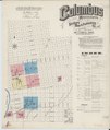 | 6,450 × 7,650 (141.17 MB) | commons>Fæ | LOC Maps multisheet https://www.loc.gov/item/sanborn04448_001/ sheet 1 of 7 #231 |
File usage
There are no pages that use this file.