File:RCID boundaries 2020-01-10.pdf
Jump to navigation
Jump to search
Size of this JPG preview of this PDF file: 388 × 600 pixels. Other resolutions: 155 × 240 pixels | 310 × 480 pixels | 497 × 768 pixels | 662 × 1,024 pixels | 1,650 × 2,550 pixels.
Original file (1,650 × 2,550 pixels, file size: 2.59 MB, MIME type: application/pdf)
File history
Click on a date/time to view the file as it appeared at that time.
| Date/Time | Thumbnail | Dimensions | User | Comment | |
|---|---|---|---|---|---|
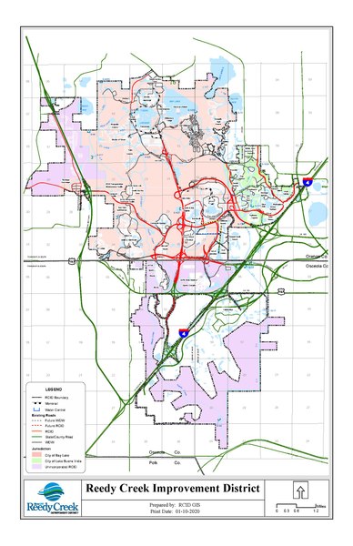
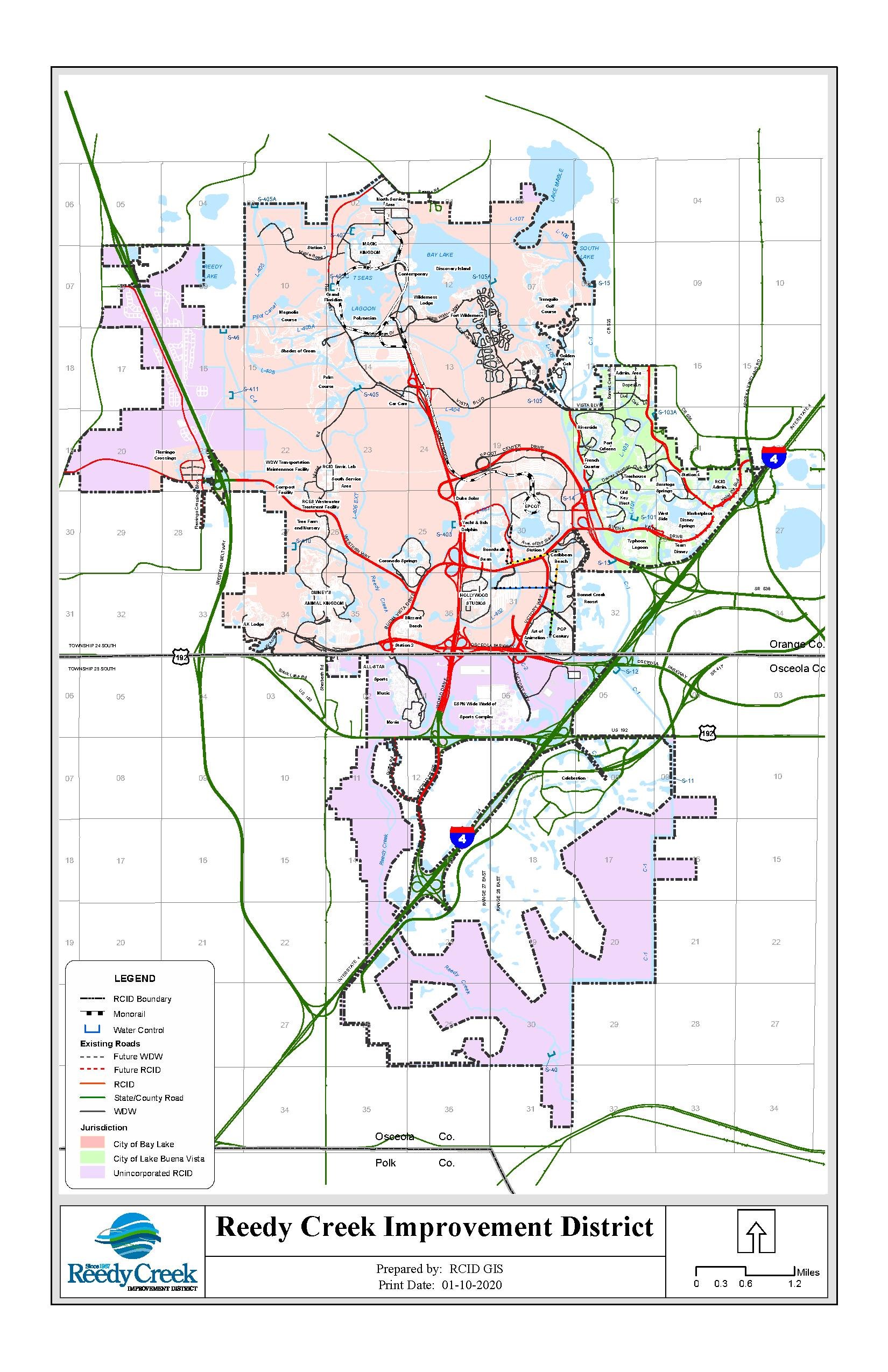
| current | 16:45, 3 May 2022 |  | 1,650 × 2,550 (2.59 MB) | commons>The Grid | A map provided by Reedy Creek Improvement District's (RCID's) GIS department displaying the boundaries of the district, the cities of Bay Lake and Lake Buena Vista, and unincorporated RCID. {{PD-FLGov}}<!--RCID operates as a municipal government--> |
File usage
There are no pages that use this file.