File:Map or Plan of Section 27. (Bounded by Broadway, Van Cortlandt Park South, Gun Hill Road, Jerome Avenue and Mount Vernon Avenue.) NYPL1526461.tiff
Jump to navigation
Jump to search

Size of this JPG preview of this TIF file: 800 × 513 pixels. Other resolutions: 320 × 205 pixels | 640 × 411 pixels | 1,024 × 657 pixels | 1,280 × 821 pixels | 2,560 × 1,642 pixels | 7,230 × 4,638 pixels.
Original file (7,230 × 4,638 pixels, file size: 95.97 MB, MIME type: image/tiff)
File history
Click on a date/time to view the file as it appeared at that time.
| Date/Time | Thumbnail | Dimensions | User | Comment | |
|---|---|---|---|---|---|
| current | 03:02, 4 May 2014 | 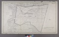 | 7,230 × 4,638 (95.97 MB) | commons>Fæ | GWToolset:: Creating mediafile for Fæ. Tranche 3 17512-20314 @ 11:54, 3 March 2014 |
File usage
There are no pages that use this file.