File:Area Map of Bladen Lakes State Forest.pdf
Jump to navigation
Jump to search
Size of this JPG preview of this PDF file: 463 × 599 pixels. Other resolutions: 185 × 240 pixels | 371 × 480 pixels | 593 × 768 pixels | 1,275 × 1,650 pixels.
Original file (1,275 × 1,650 pixels, file size: 2.37 MB, MIME type: application/pdf)
File history
Click on a date/time to view the file as it appeared at that time.
| Date/Time | Thumbnail | Dimensions | User | Comment | |
|---|---|---|---|---|---|
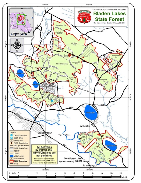
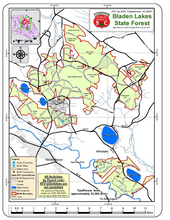
| current | 15:12, 25 August 2015 |  | 1,275 × 1,650 (2.37 MB) | commons>Ellchen1 | {{subst:Upload marker added by en.wp UW}} {{Information |Description = {{en|This is a map of Bladen Lakes State Forest. It shows the boundaries and the main roads, waterways cemeteries and camping site within the State Forest.}} |Source = I created th... |
File usage
There are no pages that use this file.