Devalls, Louisiana
Jump to navigation
Jump to search
DeValls | |
|---|---|
 DeValls Location of DeValls in Louisiana | |
| Coordinates: 30°31′34.8″N 91°17′43.1″W / 30.526333°N 91.295306°W[1] | |
| Country | United States |
| State | Louisiana |
| Parish | West Baton |
| Elevation | 30 ft (9 m) |
| Population (2007) | |
| • Total | 900 |
| Time zone | UTC-6 (CST) |
| • Summer (DST) | UTC-5 (CDT) |
| ZIP code | 70767 |
| Area code | 225 |
DeValls (also known as Devalls, DeVall, or Devall) is an unincorporated community in the 5th Ward of West Baton Rouge Parish, Louisiana, United States.[2] DeValls is located approximately 20 miles northwest of Baton Rouge, and is a part of the Baton Rouge metropolitan area. The community is situated along the Mississippi River in northeastern West Baton Rouge. The community is served by Louisiana Highway 415, known locally as the River Road. Nearby Devall Middle School is similarly named.
References
- ^ a b "DeValls, Louisiana". Geographic Names Information System. United States Geological Survey. June 4, 1980. Retrieved June 29, 2008.
- ^ "Devalls Populated Place Profile / West Baton Rouge Parish, Louisiana Data".
Municipalities and communities of West Baton Rouge Parish, Louisiana, United States | ||
|---|---|---|
| City | 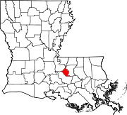 | |
| Towns | ||
| CDP | ||
| Unincorporated communities | ||
This Louisiana state location article is a stub. You can help Wikipedia by expanding it. |
Categories:
- Use mdy dates from July 2023
- Articles with short description
- Short description is different from Wikidata
- Coordinates on Wikidata
- Baton Rouge metropolitan area
- Unincorporated communities in West Baton Rouge Parish, Louisiana
- Unincorporated communities in Louisiana
- All stub articles
- Louisiana geography stubs