Chesterfield, Tennessee
Jump to navigation
Jump to search
Chesterfield, Tennessee | |
|---|---|
 Chesterfield  Chesterfield | |
| Coordinates: 35°38′04″N 88°16′01″W / 35.63444°N 88.26694°W | |
| Country | United States |
| State | Tennessee |
| County | Henderson |
| Area | |
| • Total | 7.70 sq mi (19.93 km2) |
| • Land | 7.68 sq mi (19.90 km2) |
| • Water | 0.01 sq mi (0.04 km2) |
| Elevation | 404 ft (123 m) |
| Population | |
| • Total | 543 |
| • Density | 70.68/sq mi (27.29/km2) |
| Time zone | UTC-6 (Central (CST)) |
| • Summer (DST) | UTC-5 (CDT) |
| ZIP code | 38351[3] |
| Area code | 731 |
| GNIS feature ID | 1280369[4] |
Chesterfield is a census-designated place and unincorporated community in Henderson County, Tennessee, United States. Its population was 469 as of the 2010 census.[5]
Demographics
| Census | Pop. | Note | %± |
|---|---|---|---|
| 2020 | 543 | — | |
| U.S. Decennial Census[6] | |||
References
- ^ "ArcGIS REST Services Directory". United States Census Bureau. Retrieved October 15, 2022.
- ^ "Census Population API". United States Census Bureau. Retrieved October 15, 2022.
- ^ "Chesterfield TN ZIP Code". zipdatamaps.com. 2023. Retrieved February 17, 2023.
- ^ "Chesterfield". Geographic Names Information System. United States Geological Survey, United States Department of the Interior.
- ^ "U.S. Census website". United States Census Bureau. Retrieved May 14, 2011.
- ^ "Census of Population and Housing". Census.gov. Retrieved June 4, 2016.
Municipalities and communities of Henderson County, Tennessee, United States | ||
|---|---|---|
| Cities | 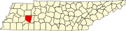 | |
| Towns | ||
| CDPs | ||
| Other communities | ||
| Footnotes | ‡This populated place also has portions in an adjacent county or counties | |
This Henderson County, Tennessee geography–related article is a stub. You can help Wikipedia by expanding it. |
Categories:
- Pages using gadget WikiMiniAtlas
- Use mdy dates from March 2024
- Articles with short description
- Short description is different from Wikidata
- Coordinates on Wikidata
- Census-designated places in Henderson County, Tennessee
- Census-designated places in Tennessee
- Unincorporated communities in Tennessee
- All stub articles
- West Tennessee geography stubs