Bartonsville, Virginia
Jump to navigation
Jump to search
Bartonsville, Virginia | |
|---|---|
 Bartonsville  Bartonsville | |
| Coordinates: 39°6′41″N 78°12′43″W / 39.11139°N 78.21194°W | |
| Country | United States |
| State | Virginia |
| County | Frederick |
| Time zone | UTC−5 (Eastern (EST)) |
| • Summer (DST) | UTC−4 (EDT) |
| GNIS feature ID | 1499094[1] |
Bartonsville is an unincorporated community located along Opequon Creek in Frederick County, Virginia between Winchester and Stephens City. Bartonsville is on Springdale Road (SR 649) to the west of Valley Pike (US 11). Historically, it has been referred to as Barton's Mill and Bartonville. The area of Bartonsville was first settled by the Hite Family in 1733. During the American Civil War, the village was garrisoned with a small stone fort of unknown location held by the Union Army.
Historic sites
- Springdale (John Hite House) (1753)
- Springdale Mill Complex (1788)
References
Wikimedia Commons has media related to Bartonville, Virginia.
Municipalities and communities of Frederick County, Virginia, United States | ||
|---|---|---|
| Towns | 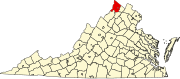 | |
| CDPs | ||
| Other communities |
| |
This Frederick County, Virginia state location article is a stub. You can help Wikipedia by expanding it. |
Categories:
- Articles with short description
- Short description is different from Wikidata
- Use mdy dates from July 2023
- Coordinates on Wikidata
- Commons category link is on Wikidata
- Unincorporated communities in Frederick County, Virginia
- Unincorporated communities in Virginia
- All stub articles
- Frederick County, Virginia geography stubs