Austerlitz, Kentucky
Jump to navigation
Jump to search
Austerlitz, Kentucky | |
|---|---|
 Austerlitz, Kentucky | |
| Coordinates: 38°5′26″N 84°13′1″W / 38.09056°N 84.21694°W | |
| Country | United States |
| State | Kentucky |
| County | Bourbon |
| Elevation | 928 ft (283 m) |
| Time zone | UTC-5 (Eastern (EST)) |
| • Summer (DST) | UTC-4 (EDT) |
| GNIS feature ID | 507429[1] |
Austerlitz is an unincorporated community in Bourbon County, Kentucky, United States.
It is located along Kentucky Route 57 approximately nine miles south of Paris, Kentucky and 17 miles east of Lexington. It was location of a former station of the Kentucky Central Railroad (which later became part of the Louisville and Nashville Railroad), along the section of line that runs between Paris and Winchester.
The name of the community likely commemorates the Battle of Austerlitz. A post office operated in the community from 1884 to 1954.[2]
References
- ^ U.S. Geological Survey Geographic Names Information System: Austerlitz, Kentucky
- ^ Austerlitz - Kentucky Atlas and Gazetteer, kyatlas.com, Retrieved 10 December 2013
Municipalities and communities of Bourbon County, Kentucky, United States | ||
|---|---|---|
| Cities | 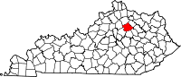 | |
| Unincorporated communities | ||
This Bourbon County, Kentucky state location article is a stub. You can help Wikipedia by expanding it. |
Categories:
- Pages using gadget WikiMiniAtlas
- Articles with short description
- Short description is different from Wikidata
- Use mdy dates from July 2023
- Coordinates on Wikidata
- Unincorporated communities in Bourbon County, Kentucky
- Unincorporated communities in Kentucky
- All stub articles
- Bourbon County, Kentucky geography stubs