Archer, Nebraska
Archer, Nebraska | |
|---|---|
 | |
 Archer  Archer | |
| Coordinates: 41°10′00″N 98°08′20″W / 41.16667°N 98.13889°W | |
| Country | United States |
| State | Nebraska |
| County | Merrick |
| Area | |
| • Total | 1.00 sq mi (2.60 km2) |
| • Land | 1.00 sq mi (2.60 km2) |
| • Water | 0.00 sq mi (0.00 km2) |
| Elevation | 1,745 ft (532 m) |
| Population | |
| • Total | 68 |
| • Density | 67.86/sq mi (26.19/km2) |
| Time zone | UTC-6 (Central (CST)) |
| • Summer (DST) | UTC-5 (CDT) |
| ZIP code | 68816 |
| FIPS code | 31-01920 |
| GNIS feature ID | 2583872[2] |
Archer is an unincorporated rural small town and census-designated place (CDP) in Merrick County, Nebraska, United States. As of the 2020 census the population was 68.[3] The Archer post office carries the ZIP Code 68816.[4]
History
The community is named for Robert T. Archer.[5] A post office was established at Archer in 1887,[6] and it is still in use.
Geography
Archer is in northwestern Merrick County, lying along local roads south of Nebraska Highway 92 and about 10 miles (16 km) northwest of Central City, the county seat.[7] There is a credit union, a grainery and other businesses and services, as well as homes, in the community.
According to the U.S. Census Bureau, the Archer CDP has an area of 1.00 square mile (2.59 km2), all of it recorded as land.[1] Prairie Creek passes through the south side of the community, flowing northeast to join the Platte River between Silver Creek and Columbus.
Demographics
| Census | Pop. | Note | %± |
|---|---|---|---|
| 2010 | 81 | — | |
| 2020 | 68 | −16.0% | |
| U.S. Decennial Census[3][8] | |||
References
- ^ a b "2023 U.S. Gazetteer Files: Nebraska". United States Census Bureau. Retrieved June 20, 2024.
- ^ a b U.S. Geological Survey Geographic Names Information System: Archer, Nebraska
- ^ a b c "P1. Race – Archer CDP, Nebraska: 2020 DEC Redistricting Data (PL 94-171)". U.S. Census Bureau. Retrieved June 20, 2024.
- ^ Zip Code Lookup Archived June 15, 2011, at the Wayback Machine
- ^ Geographic Names Information System Feature Detail Report, Geographic Names Information System, 1979-03-09. Accessed 2008-04-26.
- ^ "Merrick County". Jim Forte Postal History. Archived from the original on August 20, 2014. Retrieved August 19, 2014.
- ^ Google Maps
- ^ "P1. Race – Archer CDP, Nebraska: 2010 DEC Redistricting Data (PL 94-171)". U.S. Census Bureau. Retrieved June 20, 2024.
Municipalities and communities of Merrick County, Nebraska, United States | ||
|---|---|---|
| City | 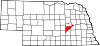 | |
| Villages | ||
| Townships | ||
| CDP | ||
| Other communities | ||
This Merrick County, Nebraska state location article is a stub. You can help Wikipedia by expanding it. |
- Pages using gadget WikiMiniAtlas
- Webarchive template wayback links
- Use mdy dates from July 2023
- Articles with short description
- Short description is different from Wikidata
- Coordinates on Wikidata
- Census-designated places in Merrick County, Nebraska
- Census-designated places in Nebraska
- All stub articles
- Eastern Nebraska geography stubs