Únehle
Jump to navigation
Jump to search
Únehle | |
|---|---|
 Pond in the centre of Únehle | |
 Flag  Coat of arms | |
 Únehle Location in the Czech Republic | |
| Coordinates: 49°47′30″N 13°0′56″E / 49.79167°N 13.01556°E | |
| Country | |
| Region | Plzeň |
| District | Tachov |
| First mentioned | 1115 |
| Area | |
| • Total | 6.06 km2 (2.34 sq mi) |
| Elevation | 449 m (1,473 ft) |
| Population (2023-01-01)[1] | |
| • Total | 138 |
| • Density | 23/km2 (59/sq mi) |
| Time zone | UTC+1 (CET) |
| • Summer (DST) | UTC+2 (CEST) |
| Postal code | 349 01 |
| Website | www |
Únehle is a municipality and village in Tachov District in the Plzeň Region of the Czech Republic. It has about 100 inhabitants.
Únehle lies approximately 30 kilometres (19 mi) east of Tachov, 26 km (16 mi) west of Plzeň, and 106 km (66 mi) west of Prague.
Demographics
| Year | Pop. | ±% |
|---|---|---|
| 1869 | 326 | — |
| 1880 | 343 | +5.2% |
| 1890 | 316 | −7.9% |
| 1900 | 312 | −1.3% |
| 1910 | 327 | +4.8% |
| 1921 | 299 | −8.6% |
| 1930 | 299 | +0.0% |
| 1950 | 156 | −47.8% |
| 1961 | 146 | −6.4% |
| 1970 | 136 | −6.8% |
| 1980 | 102 | −25.0% |
| 1991 | 103 | +1.0% |
| 2001 | 109 | +5.8% |
| 2011 | 119 | +9.2% |
| 2021 | 138 | +16.0% |
| Source: Censuses[2][3] | ||
Gallery
-
 Bus stop
 -
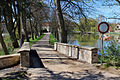 Stone bridge
 -
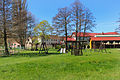 Playground


References
- ^ "Population of Municipalities – 1 January 2023". Czech Statistical Office. 2023-05-23.
- ^ "Historický lexikon obcí České republiky 1869–2011 – Okres Tachov" (in Czech). Czech Statistical Office. 2015-12-21. pp. 19–20.
- ^ "Population Census 2021: Population by sex". Public Database. Czech Statistical Office. 2021-03-27.
External links
Wikimedia Commons has media related to Únehle.
| Authority control databases: National |
|---|
This Plzeň Region location article is a stub. You can help Wikipedia by expanding it. |
Categories:
- Pages using gadget WikiMiniAtlas
- CS1 Czech-language sources (cs)
- Articles with short description
- Short description is different from Wikidata
- Coordinates on Wikidata
- Commons category link is on Wikidata
- Official website different in Wikidata and Wikipedia
- Articles with NKC identifiers
- Villages in Tachov District
- All stub articles
- Plzeň Region geography stubs