Portal:Tropical cyclones
The Tropical Cyclones Portal
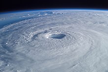
A tropical cyclone is a storm system characterized by a large low-pressure center, a closed low-level circulation and a spiral arrangement of numerous thunderstorms that produce strong winds and heavy rainfall. Tropical cyclones feed on the heat released when moist air rises, resulting in condensation of water vapor contained in the moist air. They are fueled by a different heat mechanism than other cyclonic windstorms such as Nor'easters, European windstorms and polar lows, leading to their classification as "warm core" storm systems. Most tropical cyclones originate in the doldrums, approximately ten degrees from the Equator.
The term "tropical" refers to both the geographic origin of these systems, which form almost exclusively in tropical regions of the globe, as well as to their formation in maritime tropical air masses. The term "cyclone" refers to such storms' cyclonic nature, with anticlockwise rotation in the Northern Hemisphere and clockwise rotation in the Southern Hemisphere. Depending on its location and intensity, a tropical cyclone may be referred to by names such as "hurricane", "typhoon", "tropical storm", "cyclonic storm", "tropical depression" or simply "cyclone".
Types of cyclone: 1. A "Typhoon" is a tropical cyclone located in the North-west Pacific Ocean which has the most cyclonic activity and storms occur year-round. 2. A "Hurricane" is also a tropical cyclone located at the North Atlantic Ocean or North-east Pacific Ocean which have an average storm activity and storms typically form between May 15 and November 30. 3. A "Cyclone" is a tropical cyclone that occurs in the South Pacific and Indian Oceans.
Selected named cyclone -
Tropical Storm Imelda was a tropical cyclone which was the fourth-wettest storm on record in the U.S. state of Texas, causing devastating and record-breaking floods in southeast Texas. The eleventh tropical cyclone and ninth named storm of the 2019 Atlantic hurricane season, Imelda formed out of an upper-level low that developed in the Gulf of Mexico and moved westward. Little development occurred until the system was near the Texas coastline, where it rapidly developed into a tropical storm before moving ashore shortly afterward on September 17. Imelda weakened after landfall, but continued bringing large amounts of flooding rain to Texas and Louisiana, before dissipating on September 21.
Impacts began when Imelda made landfall as a weak tropical storm. The system brought heavy rain and dangerous flooding to parts of southeastern Texas (especially the cities of Galveston and Beaumont) as its motion gradually slowed over land. Dozens of water rescues were needed by September 19 as areas became overwhelmed by the rainfall, with some areas experiencing over 43 inches (1,100 mm) of rain. Total damage is estimated in excess of $5 billion (2019 USD). Despite the storm causing substantial damage, the name Imelda was not retired following the season, making Imelda the second-costliest Atlantic tropical cyclone name on record to not be retired, with the costliest being Hurricane Sally the following year. (Full article...)Selected article -
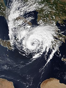
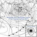
Mediterranean tropical-like cyclones, often referred to as Mediterranean cyclones or Mediterranean hurricanes, and shortened as medicanes, are meteorological phenomena occasionally observed over the Mediterranean Sea. On a few rare occasions, some storms have been observed reaching the strength of a Category 1 hurricane, on the Saffir–Simpson scale, and Cyclone Ianos in 2020 was recorded reaching Category 2 intensity. The main societal hazard posed by medicanes is not usually from destructive winds, but through life-threatening torrential rains and flash floods.
The occurrence of medicanes has been described as not particularly rare. Tropical-like systems were first identified in the Mediterranean basin in the 1980s, when widespread satellite coverage showing tropical-looking low pressures which formed a cyclonic eye in the center were identified. Due to the dry nature of the Mediterranean region, the formation of tropical, subtropical cyclones and tropical-like cyclones is infrequent and also hard to detect, in particular with the reanalysis of past data. Depending on the search algorithms used, different long-term surveys of satellite era and pre-satellite era data came up with 67 tropical-like cyclones of tropical storm intensity or higher between 1947 and 2014, and around 100 recorded tropical-like storms between 1947 and 2011. More consensus exists about the long term temporal and spatial distribution of tropical-like cyclones: they form predominantly over the western and central Mediterranean Sea while the area east of Crete is almost devoid of tropical-like cyclones. The development of tropical-like cyclones can occur year-round, with activity historically peaking between the months of September and January, while the counts for the summer months of June and July are the lowest, being within the peak dry season of the Mediterranean with stable air. (Full article...)Selected image -
Selected season -

The 2019 Atlantic hurricane season was the fourth consecutive above-average and damaging season dating back to 2016. The season featured eighteen named storms, however, many storms were weak and short-lived, especially towards the end of the season. Six of those named storms achieved hurricane status, while three intensified into major hurricanes. Two storms became Category 5 hurricanes, marking the fourth consecutive season with at least one Category 5 hurricane, the third consecutive season to feature at least one storm making landfall at Category 5 intensity, and the seventh on record to have multiple tropical cyclones reaching Category 5 strength. The season officially began on June 1 and ended on November 30. These dates historically describe the period each year when most tropical cyclones form in the Atlantic basin and are adopted by convention. However, tropical cyclogenesis is possible at any time of the year, as demonstrated by the formation of Subtropical Storm Andrea on May 20, making this the fifth consecutive year in which a tropical or subtropical cyclone developed outside of the official season.
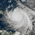
The season's first hurricane, Barry, formed in mid-July in the northern Gulf of Mexico and struck Louisiana. Barry caused two deaths and produced flooding in Arkansas, Alabama, Louisiana, and Mississippi, with damage totaling about $600 million (2019 USD). Hurricane Dorian, the most intense tropical cyclone of the season, proved to be the costliest natural disaster in the history of the Bahamas, becoming the strongest hurricane to strike the country. Overall, Dorian caused about $5.1 billion in damage and 84 fatalities, mostly in the Bahamas. The 2019 season was the record fourth consecutive season to feature at least one Category 5 hurricane. Tropical Storm Fernand left flooding in Mexico, with approximately $11.3 million in damage and one death. Hurricane Humberto produced extensive damage in Bermuda, totaling at least $25 million. (Full article...)Related portals
Currently active tropical cyclones

Italicized basins are unofficial.
- North Atlantic (2024)
- No active systems
- East and Central Pacific (2024)
- No active systems
- West Pacific (2024)
- No active systems
- North Indian Ocean (2024)
- No active systems
- Mediterranean (2023–24)
- No active systems
- South-West Indian Ocean (2023–24)
- No active systems
- Australian region (2023–24)
- No active systems
- South Pacific (2023–24)
- No active systems
- South Atlantic (2023–24)
- No active systems
Last updated: 21:54, 8 May 2024 (UTC)
Tropical cyclone anniversaries

May 20
- 1989 - Typhoon Brenda makes landfall over Southern China as a Category 1 typhoon, killing about 84 people.
- 1999 - A powerful cyclone (pictured) struck southeastern Pakistan, killing at least 400 people, and perhaps as many as 6,000.
- 2005 - Tropical Depression Adrian became the first Pacific tropical cyclone to strike the Pacific coast of Honduras.

May 21
- 1976 - Typhoon Pamela passed over Guam with winds of 220 km/h (140 mph) and caused over $500 million of damage to the island.
- 2010 - Cyclone Laila (pictured) dissipates after causing destruction over the Andhra Pradesh region of India.

- May 22, 1996 - Tropical Storm Cam (pictured) reached its peak intensity with 110 km/h (70 mph) while moving to the east through the Luzon Strait between the Philippines and Taiwan.
Did you know…


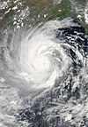
- …that the Joint Typhoon Warning Center considers that Typhoon Vera (pictured) of 1986 is actually two distinct systems, formed from two separated low-level circulations?
- …that Hurricane Agatha (pictured) was the strongest Pacific hurricane to make landfall in Mexico in May since records began in 1949?
- …that Cyclone Raquel (track pictured) travelled between the Australian and South Pacific basins between the 2014–15 and 2015–16 seasons, spanning both seasons in both basins?
- …that Cyclone Amphan (pictured) in 2020 was the first storm to be classified as a Super Cyclonic Storm in the Bay of Bengal since 1999?
General images -

The 2005 Atlantic hurricane season was an event in the annual tropical cyclone season in the north Atlantic Ocean. It was the second most active Atlantic hurricane season in recorded history, and the most extreme (i.e. produced the highest accumulated cyclone energy (ACE)) in the satellite era. Officially, the season began on June 1, 2005 and ended on November 30, 2005. These dates, adopted by convention, historically delimit the period in each year when most tropical systems form. The season's first storm, Tropical Storm Arlene, developed on June 8. The final storm, Tropical Storm Zeta, formed in late December and persisted until January 6, 2006. Zeta is only the second December Atlantic storm in recorded history to survive into January, joining Hurricane Alice in 1955.
The season's impact was widespread and catastrophic. Its storms touched virtually every part of the Atlantic basin. Altogether, there were 28 named tropical storms during the season, exhausting the annual pre-designated list and resulting in the usage of six Greek letter names. A record 15 tropical storms attained hurricane strength, of which a record seven intensified into major hurricanes. Six hurricanes made landfall or near-landfall on the U.S. during the season: Cindy, Dennis, Katrina, Ophelia, Rita and Wilma. Record-breaking 2005 hurricanes included:
- Emily, the strongest hurricane ever on record to form in the month of July, with peak winds of 160 mph (260 km/h), later weakening and striking Mexico twice;
- Katrina, which became the costliest tropical cyclone on record, causing over 1,200 deaths and $125 billion in damage, particularly in the city of New Orleans and the surrounding areas;
- Wilma, which became the most intense Atlantic hurricane on record, recording a barometric pressure of 882 mbar (hPa; 26.05 inHg).
Topics
Subcategories
Related WikiProjects
WikiProject Tropical cyclones is the central point of coordination for Wikipedia's coverage of tropical cyclones. Feel free to help!
WikiProject Weather is the main center point of coordination for Wikipedia's coverage of meteorology in general, and the parent project of WikiProject Tropical cyclones. Three other branches of WikiProject Weather in particular share significant overlaps with WikiProject Tropical cyclones:
- The Non-tropical storms task force coordinates most of Wikipedia's coverage on extratropical cyclones, which tropical cyclones often transition into near the end of their lifespan.
- The Floods task force takes on the scope of flooding events all over the world, with rainfall from tropical cyclones a significant factor in many of them.
- WikiProject Severe weather documents the effects of extreme weather such as tornadoes, which landfalling tropical cyclones can produce.
Things you can do
 |
Here are some tasks awaiting attention:
|
Wikimedia
The following Wikimedia Foundation sister projects provide more on this subject:
-
Commons
Free media repository -
Wikibooks
Free textbooks and manuals -
Wikidata
Free knowledge base -
Wikinews
Free-content news -
Wikiquote
Collection of quotations -
Wikisource
Free-content library -
Wikiversity
Free learning tools -
Wikivoyage
Free travel guide -
Wiktionary
Dictionary and thesaurus
- Manually maintained portal pages from June 2018
- All manually maintained portal pages
- Portals with triaged subpages from June 2018
- All portals with triaged subpages
- All portals
- Portals with named maintainer
- Random portal component with 31–40 available image subpages
- Tropical cyclones portal
- Physical science portals
- Tropical cyclones
- Redirect targets of redirected portals with existing subpages
- WikiProject Tropical cyclones

