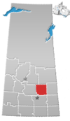
Nut Mountain
Nut Mountain | |
|---|---|
Unincorporated community | |
| Coordinates: 52°07′37″N 103°22′44″W / 52.127°N 103.379°W | |
| Country | Canada |
| Province | Saskatchewan |
| Region | West Central Saskatchewan |
| Census division | 10 |
| Rural municipality | Sasman No. 336 |
| Area | |
| • Total | 0.32 km2 (0.12 sq mi) |
| Population (2016) | |
| • Total | 10 |
| • Density | 31.3/km2 (81/sq mi) |
| Time zone | CST |
| Area code | 306 |
| Highways | Highway 49 |
| Railways | Canadian National Railway (abandoned) |
Nut Mountain is an unincorporated community in the Rural Municipality of Sasman No. 336, Saskatchewan, Canada. Listed as a designated place by Statistics Canada, the community had a population of 10 in the Canada 2016 Census.[1]
Demographics
In the 2021 Census of Population conducted by Statistics Canada, Nut Mountain had a population of 5 living in 3 of its 4 total private dwellings, a change of -50% from its 2016 population of 10. With a land area of 0.34 km2 (0.13 sq mi), it had a population density of 14.7/km2 (38.1/sq mi) in 2021.[2]
| 2016 | |
|---|---|
| Population | 10 (0.0% from 2011) |
| Land area | 0.32 km2 (0.12 sq mi) |
| Population density | 31.3/km2 (81/sq mi) |
| Median age | |
| Private dwellings | 9 (total) |
| Median household income | $N/A |
Nut Mountain
Nut Mountain is a large hill (52°5′N 103°10′W / 52.083°N 103.167°W)[6] in the east-central region of Saskatchewan. The mountain and several other nearby landmarks[7] are named after the wild hazel nuts that grow abound in the countryside.[8] The Assiniboine River has its headwaters near the Nut Hills.[9]
See also
References
- ^ Canada 2016 Census: Designated places in Saskatchewan
- ^ "Population and dwelling counts: Canada and designated places". Statistics Canada. February 9, 2022. Retrieved August 31, 2022.
- ^ "2016 Community Profiles". 2016 Canadian Census. Statistics Canada. August 12, 2021.
- ^ "2006 Community Profiles". 2006 Canadian Census. Statistics Canada. August 20, 2019.
- ^ "2001 Community Profiles". 2001 Canadian Census. Statistics Canada. July 18, 2021.
- ^ "Nut Mountain". Canadian Geographical Names Database. Government of Canada. Retrieved February 19, 2023.
- ^ Nut Mountain Archived 2008-11-15 at the Wayback Machine, epodunk.com
- ^ OONG-KA-CHOONK Archived 2011-05-21 at the Wayback Machine, Ron Petrie, Regina Leader-Post, Jan. 5, 2005
- ^ Assiniboine River Archived 2011-11-13 at the Wayback Machine, Encyclopedia of Saskatchewan
- Pages using gadget WikiMiniAtlas
- Webarchive template wayback links
- Articles with short description
- Short description is different from Wikidata
- Use mdy dates from September 2023
- Use Canadian English from January 2023
- All Wikipedia articles written in Canadian English
- Coordinates on Wikidata
- Sasman No. 336, Saskatchewan
- Designated places in Saskatchewan
- Unincorporated communities in Saskatchewan
- Hills of Saskatchewan
- Division No. 10, Saskatchewan

