Mookgophong
(Redirected from Naboomspruit)
Mookgophong
Naboomspruit | |
|---|---|
| Coordinates: 24°31′S 28°43′E / 24.517°S 28.717°E | |
| Country | South Africa |
| Province | Limpopo |
| District | Waterberg |
| Municipality | Modimolle–Mookgophong |
| Established | 1907 |
| • Councillor | (ANC) |
| Area | |
| • Total | 27.18 km2 (10.49 sq mi) |
| Population (2011)[1] | |
| • Total | 24,853 |
| • Density | 910/km2 (2,400/sq mi) |
| Racial makeup (2011) | |
| • Black African | 88.1% |
| • Coloured | 0.4% |
| • Indian/Asian | 0.2% |
| • White | 10.9% |
| • Other | 0.5% |
| First languages (2011) | |
| • Northern Sotho | 56.3% |
| • Tsonga | 13.7% |
| • Afrikaans | 10.9% |
| • Sotho | 6.1% |
| • Other | 12.9% |
| Time zone | UTC+2 (SAST) |
| Postal code (street) | 0560 |
| PO box | 0560 |
| Area code | 014 |
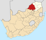
Mookgophong, formerly known as Naboomspruit, is a town in the Limpopo province of South Africa. The town is located approximately 42 km north-east of Modimolle and 51 km south-west of Mokopane.
History
It was founded on the farm Vischgat in 1907 and administered by a health committee from 1919. The name Naboomspruit is Afrikaans but derived from Khoekhoen; ‘euphorbia tree stream’, after the Euphorbia ingens which grows there.[2] The town was officially renamed Mookgophong on the 24 November 2006, by the South African government.[3]
References
- ^ a b c d "Main Place Mookgophong". Census 2011.
- ^ "Dictionary of Southern African Place Names (Public Domain)". Human Science Research Council. p. 325.
- ^ Old place names Archived 2010-02-08 at the Wayback Machine
Categories:
- Pages using gadget WikiMiniAtlas
- Webarchive template wayback links
- Use dmy dates from April 2022
- Articles with short description
- Short description matches Wikidata
- Coordinates on Wikidata
- Articles with VIAF identifiers
- Articles with WorldCat Entities identifiers
- Articles with J9U identifiers
- Articles with LCCN identifiers
- Populated places in the Modimolle–Mookgophong Local Municipality
- Populated places established in 1907
- All stub articles
- Limpopo geography stubs


