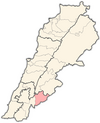
Mimess
(Redirected from Mimass)
Mimess
ميمس | |
|---|---|
village | |
| Coordinates: 33°25′11″N 35°42′51″E / 33.41972°N 35.71417°E | |
| Country | |
| Governorate | Nabatieh Governorate |
| District | Hasbaya District |
| Elevation | 800 m (2,600 ft) |
| Time zone | UTC+2 (EET) |
| • Summer (DST) | UTC+3 (EEST) |
Mimess (Arabic: ميمس) is a local authority the Hasbaya District in Lebanon.
History
In 1838, during the Ottoman era, Eli Smith noted the population of Mimis as being Druze and "Greek" Christians.[1]
In 1875 Victor Guérin noted: "At nine hours fifteen minutes, I crossed the Wadi Mimas, which leads to the Wadi et-Teim. Beyond, to the north, rises, on a hill, the village of the same name. It is inhabited by Druses and schismatic Greeks. Some ruins on a mound next to this village, on the west side, are called Kharbet Ras A'ly".[2]
References
Bibliography
- Guérin, V. (1880). Description Géographique Historique et Archéologique de la Palestine (in French). Vol. 3: Galilee, pt. 2. Paris: L'Imprimerie Nationale.
- Robinson, E.; Smith, E. (1841). Biblical Researches in Palestine, Mount Sinai and Arabia Petraea: A Journal of Travels in the year 1838. Vol. 3. Boston: Crocker & Brewster.
External links
- Mimess, Localiban

