File:Worthing UK local election 2010 map.svg
Jump to navigation
Jump to search

Size of this PNG preview of this SVG file: 773 × 599 pixels. Other resolutions: 310 × 240 pixels | 619 × 480 pixels | 991 × 768 pixels | 1,280 × 993 pixels | 2,560 × 1,985 pixels | 1,425 × 1,105 pixels.
Original file (SVG file, nominally 1,425 × 1,105 pixels, file size: 139 KB)
File history
Click on a date/time to view the file as it appeared at that time.
| Date/Time | Thumbnail | Dimensions | User | Comment | |
|---|---|---|---|---|---|
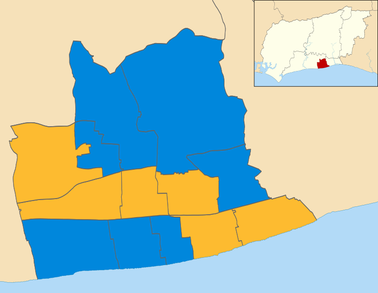
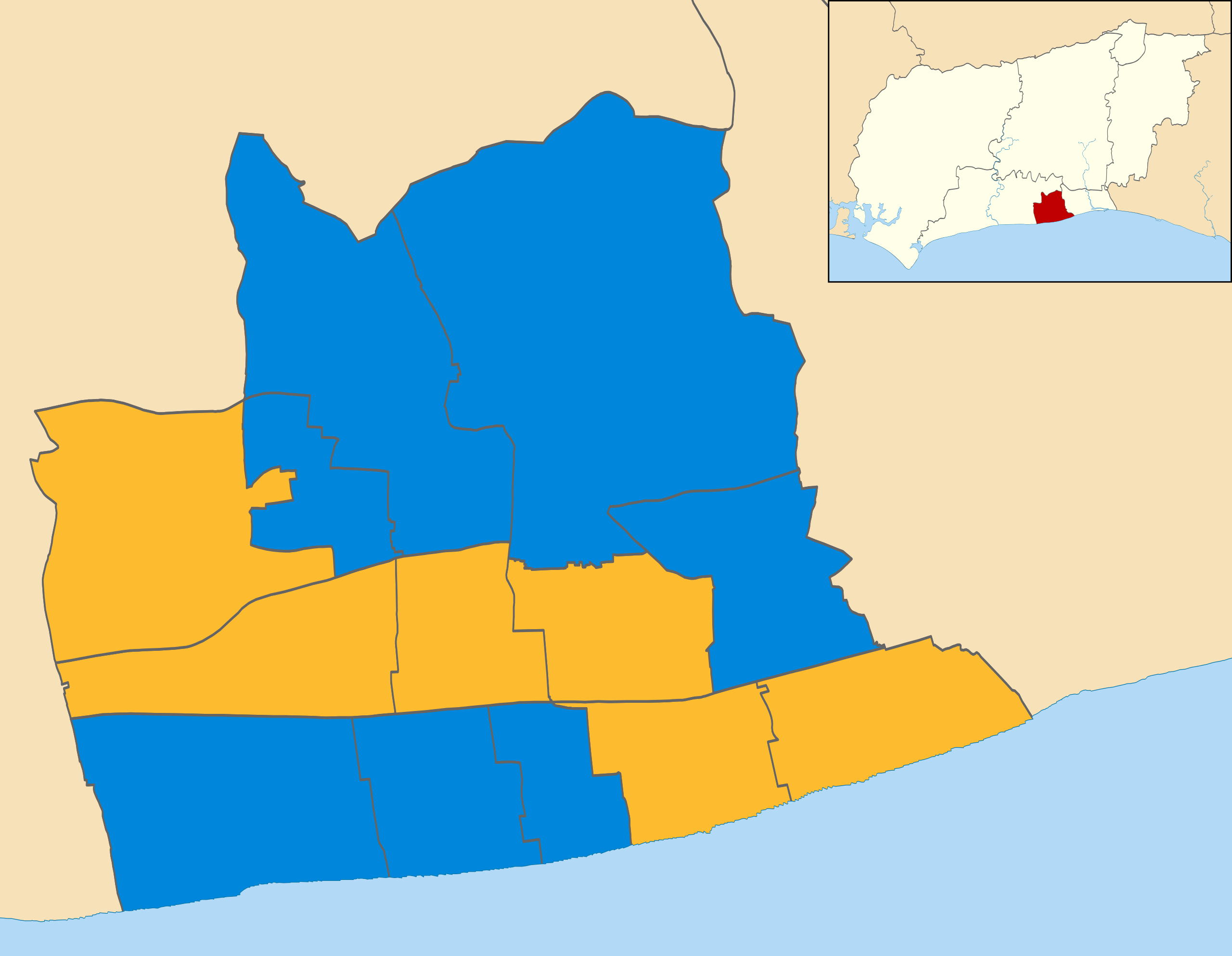
| current | 12:42, 27 August 2011 | | 1,425 × 1,105 (139 KB) | commons>Davewild | {{Information |Description=Map of Worthing, West Sussex, UK showing the results of the 2010 local election. Colours: {{legend|#0087dc|Conservative}} {{legend|#fdbb30|Liberal Democrat}} |Source=*File:Worthing_UK_ward_map_2010_(blank).svg |Date=2011- |
.svg)
File usage
There are no pages that use this file.