File:Woomera Test Range map.svg
Jump to navigation
Jump to search

Size of this PNG preview of this SVG file: 516 × 599 pixels. Other resolutions: 207 × 240 pixels | 413 × 480 pixels | 661 × 768 pixels | 882 × 1,024 pixels | 1,763 × 2,048 pixels | 1,535 × 1,783 pixels.
Original file (SVG file, nominally 1,535 × 1,783 pixels, file size: 318 KB)
File history
Click on a date/time to view the file as it appeared at that time.
| Date/Time | Thumbnail | Dimensions | User | Comment | |
|---|---|---|---|---|---|
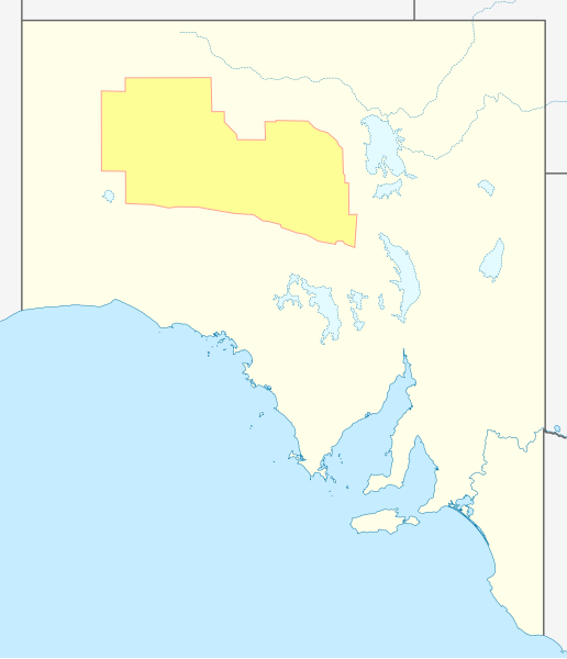
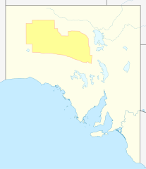
| current | 02:36, 13 July 2011 | | 1,535 × 1,783 (318 KB) | commons>Pi.1415926535 | {{Information |Description={{en|Approximate geographic map of Woomera Test Range in South Australia}} |Source=*File:Australia_South_Australia_location_map_blank.svg |Date=2011-07-13 02:28 (UTC) |Author=*[[:File:Australia_South_Australia_location_map |
File usage
There are no pages that use this file.