File:Wisteria Lane map, season 1.svg
Jump to navigation
Jump to search

Size of this PNG preview of this SVG file: 800 × 471 pixels. Other resolutions: 320 × 188 pixels | 640 × 377 pixels | 1,024 × 603 pixels | 1,280 × 754 pixels | 2,560 × 1,508 pixels | 1,056 × 622 pixels.
Original file (SVG file, nominally 1,056 × 622 pixels, file size: 32 KB)
File history
Click on a date/time to view the file as it appeared at that time.
| Date/Time | Thumbnail | Dimensions | User | Comment | |
|---|---|---|---|---|---|
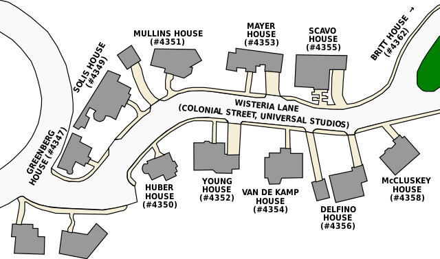
| current | 00:55, 1 May 2010 | | 1,056 × 622 (32 KB) | commons>Sesu Prime | {{Information |Description={{en|Map of the en:Wisteria Lane (otherwise known as en:Colonial Street), showing house numbers and residents in season one of ''Desperate Housewives''}} |Source=Transferred fr |
File usage
There are no pages that use this file.