File:Wao Kele SE.jpg
Jump to navigation
Jump to search

Size of this preview: 800 × 600 pixels. Other resolutions: 320 × 240 pixels | 640 × 480 pixels | 1,024 × 768 pixels | 1,280 × 960 pixels | 1,824 × 1,368 pixels.
Original file (1,824 × 1,368 pixels, file size: 344 KB, MIME type: image/jpeg)
Summary
| Description |
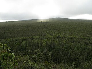
English: Wao Kele O Puna from the east. The hill on the right is Heiheiahulu. |
| Date | 08:21, 2 November 2009 (UTC) |
| Source | I (KarlM (talk)) created this work entirely by myself. |
| Author | KarlM (talk) |
Licensing
I, the copyright holder of this work, hereby publish it under the following license:
This file is licensed under the Creative Commons Attribution-Share Alike 3.0 Unported license.
- You are free:
- to share – to copy, distribute and transmit the work
- to remix – to adapt the work
- Under the following conditions:
- attribution – You must give appropriate credit, provide a link to the license, and indicate if changes were made. You may do so in any reasonable manner, but not in any way that suggests the licensor endorses you or your use.
- share alike – If you remix, transform, or build upon the material, you must distribute your contributions under the same or compatible license as the original.
File history
Click on a date/time to view the file as it appeared at that time.
| Date/Time | Thumbnail | Dimensions | User | Comment | |
|---|---|---|---|---|---|
| current | 08:21, 2 November 2009 | | 1,824 × 1,368 (344 KB) | commons>KarlM | {{Information |Description = Wao Kele O Puna from the east. The hill on the right is Heiheiahulu. |Source = I (~~~) created this work entirely by myself. |Date = ~~~~~ |Author = ~~~ |other_versions = }} |
File usage
There are no pages that use this file.