File:Vojvodina gradovi.png
Jump to navigation
Jump to search
Size of this preview: 583 × 600 pixels. Other resolutions: 233 × 240 pixels | 467 × 480 pixels | 747 × 768 pixels | 995 × 1,024 pixels | 1,952 × 2,008 pixels.
Original file (1,952 × 2,008 pixels, file size: 195 KB, MIME type: image/png)
Summary
| Description |
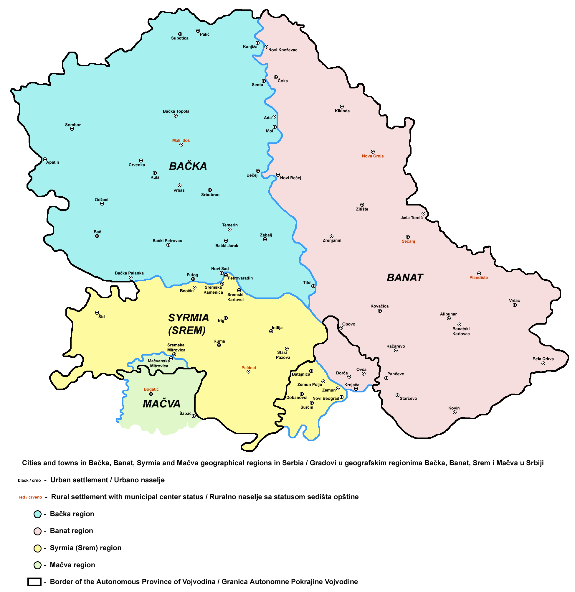
English: Cities and towns in Bačka, Banat, Syrmia and Mačva regions in Serbia
Српски / srpski: Gradovi u regionima Bačka, Banat, Srem i Mačva u Srbiji |
| Date | 21 April 2009 (original upload date) |
| Source | No machine-readable source provided. Own work assumed (based on copyright claims). |
| Author | No machine-readable author provided. PANONIAN assumed (based on copyright claims). |
References
- Slobodan Radovanović, Geografski atlas, Magic Map, Smederevska Palanka, 2001.
- Školski geografski atlas, Intersistem Kartografija, Beograd, 2004.
- Denis Šehić - Demir Šehić, Geografski atlas Srbije, Beograd, 2007.
- Popis stanovništva, domaćinstava i stanova u 2002., Stanovništvo, nacionalna ili etnička pripadnost - Podaci po naseljima, knjiga 1, Republika Srbija - Republički zavod za statistiku, Beograd, februar 2003.
Licensing
my own work
PANONIAN, the copyright holder of this work, hereby publishes it under the following license:
| I, the copyright holder of this work, release this work into the public domain. This applies worldwide. In some countries this may not be legally possible; if so: I grant anyone the right to use this work for any purpose, without any conditions, unless such conditions are required by law. |
File history
Click on a date/time to view the file as it appeared at that time.
| Date/Time | Thumbnail | Dimensions | User | Comment | |
|---|---|---|---|---|---|
| current | 12:25, 11 October 2010 | | 1,952 × 2,008 (195 KB) | commons>PANONIAN | aesthetical correction |
File usage
There are no pages that use this file.