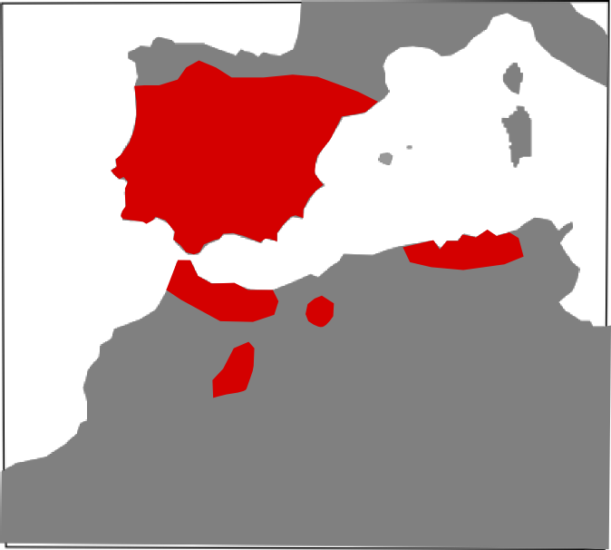
File:Vipera latastei range Map.png
Jump to navigation
Jump to search
Size of this preview: 667 × 600 pixels. Other resolutions: 267 × 240 pixels | 534 × 480 pixels | 674 × 606 pixels.
Original file (674 × 606 pixels, file size: 40 KB, MIME type: image/png)
File history
Click on a date/time to view the file as it appeared at that time.
| Date/Time | Thumbnail | Dimensions | User | Comment | |
|---|---|---|---|---|---|
| current | 09:00, 12 January 2010 | | 674 × 606 (40 KB) | commons>Carlosblh | {{Information |Description={{en|1=Vipera latastei range map.}} {{es|1=Mapa de distribución de Vipera latastei.}} |Source=Wikimedia Commons |Author=Carlos Bartolomé La Huerta |Date=01/12/2010 |Permission={{cc-by-3.0}} |other_versions=[ |
File usage
There are no pages that use this file.