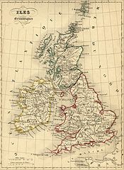
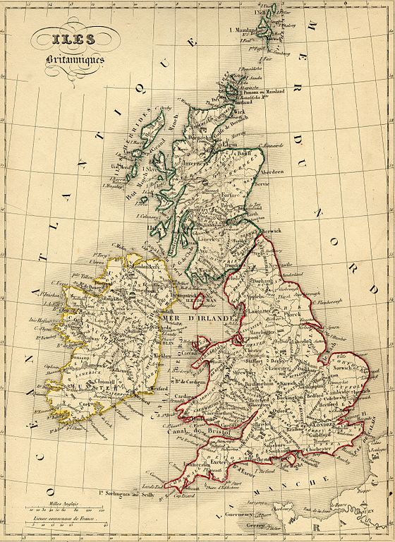
File:United Kingdom 1843.jpg
Jump to navigation
Jump to search

Size of this preview: 437 × 599 pixels. Other resolutions: 175 × 240 pixels | 350 × 480 pixels | 560 × 768 pixels | 747 × 1,024 pixels | 2,482 × 3,404 pixels.
Original file (2,482 × 3,404 pixels, file size: 3.55 MB, MIME type: image/jpeg)
File history
Click on a date/time to view the file as it appeared at that time.
| Date/Time | Thumbnail | Dimensions | User | Comment | |
|---|---|---|---|---|---|
| current | 11:39, 11 November 2007 | | 2,482 × 3,404 (3.55 MB) | commons>Dlebouc | == Description == {{Information |Description= {{fr|Carte du Royaume Uni (Angleterre, Galles, Ecosse) avec noms en français dressée par le géographe Alexandre Vuillemin en 1843 extraite de son “Atlas universel de géographie ancienne et moderne à l'u |
File usage
There are no pages that use this file.