File:USACE John H Kerr Dam and Lake.jpg
Jump to navigation
Jump to search
Size of this preview: 800 × 533 pixels. Other resolutions: 320 × 213 pixels | 640 × 427 pixels | 1,024 × 683 pixels | 1,500 × 1,000 pixels.
Original file (1,500 × 1,000 pixels, file size: 651 KB, MIME type: image/jpeg)
| Description |
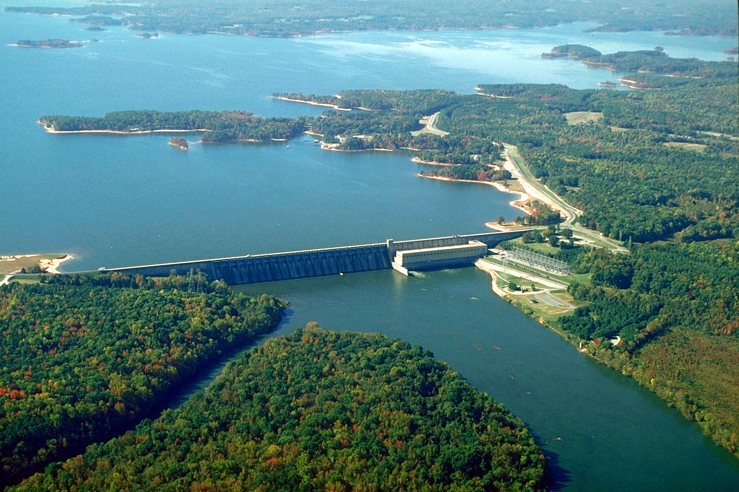
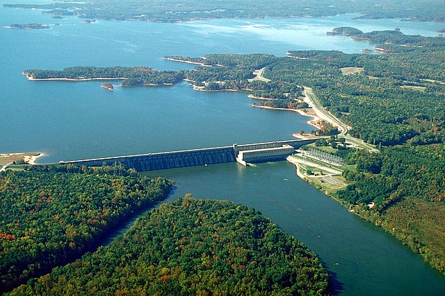
English: The John H. Kerr Dam and Lake on the Roanoke River in Mecklenburg County, Virginia, USA. The U.S. Army Corps of Engineers constructed the dam for flood control on the Roanoke River. View is to the south-southwest.
Coordinates: 36°35′53.76″N 78°17′53.63″W / 36.5982667°N 78.2982306°W |
|||
| Location | Mecklenburg County, Virginia, USA | |||
| Date | (Caveat: Dates provided by U.S. Army Corps of Engineers Digital Visual Library are not reliable and are often wrong.) | |||
| Source |
U.S. Army Corps of Engineers Digital Visual Library Image page Image description page Digital Visual Library home page |
|||
| Author | Bud Davis, U.S. Army Corps of Engineers | |||
| Permission (Reusing this file) |
|
File history
Click on a date/time to view the file as it appeared at that time.
| Date/Time | Thumbnail | Dimensions | User | Comment | |
|---|---|---|---|---|---|
| current | 04:40, 26 April 2007 | | 1,500 × 1,000 (651 KB) | commons>DanMS | {{Information | Description = {{en|The John H. Kerr Dam and Lake on the Roanoke River in Mecklenburg County, Virginia, USA. The U.S. Army Corps of Engineers constructed the dam for flood control on the Roanoke River. View is to the south-southwest.}} C |
File usage
There are no pages that use this file.