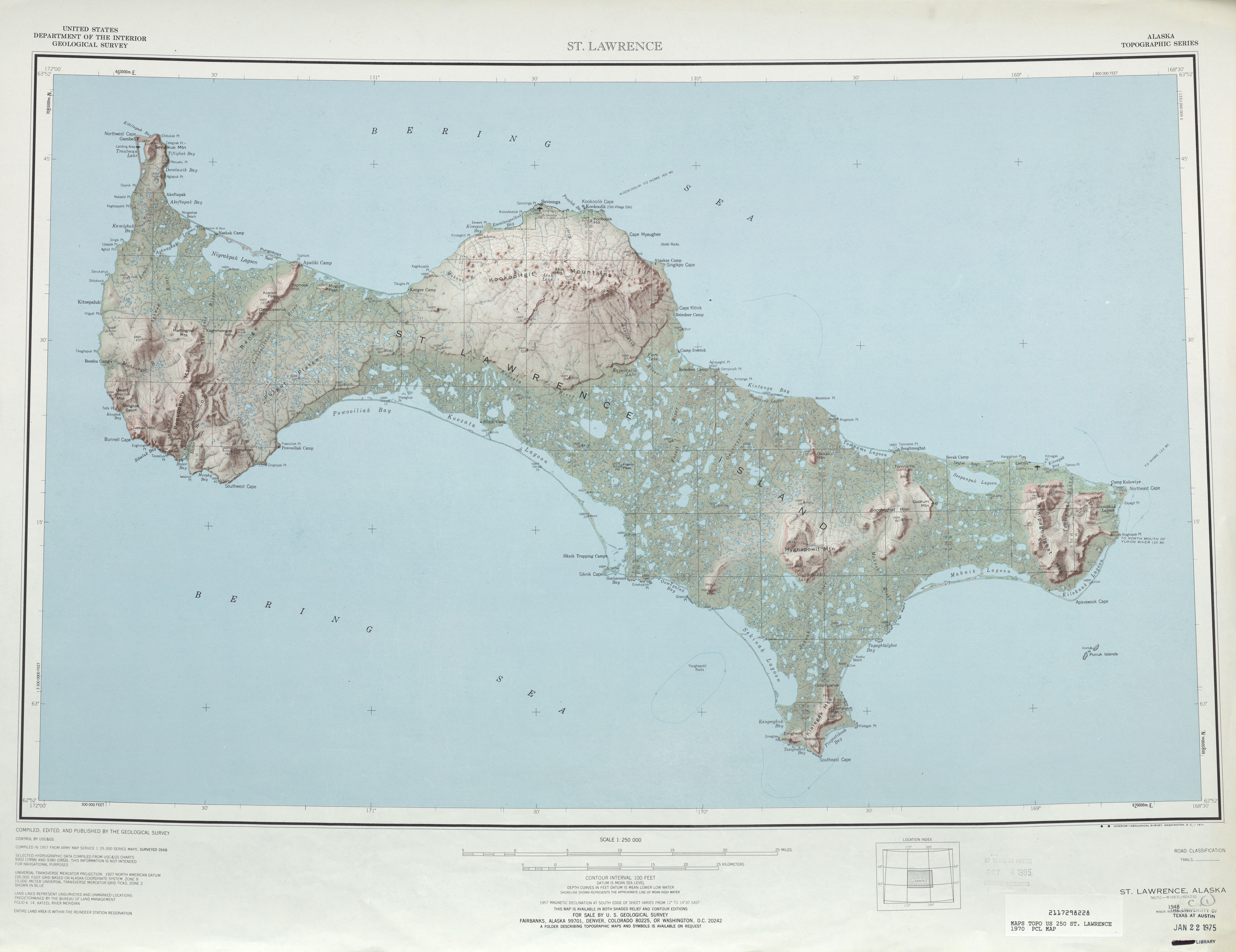
File:Txu-pclmaps-topo-us-saint lawrence-1970.jpg
Jump to navigation
Jump to search
Size of this preview: 778 × 599 pixels. Other resolutions: 312 × 240 pixels | 623 × 480 pixels | 997 × 768 pixels | 1,280 × 986 pixels | 2,560 × 1,972 pixels | 5,957 × 4,589 pixels.
Original file (5,957 × 4,589 pixels, file size: 4.29 MB, MIME type: image/jpeg)
File history
Click on a date/time to view the file as it appeared at that time.
| Date/Time | Thumbnail | Dimensions | User | Comment | |
|---|---|---|---|---|---|
| current | 21:45, 1 October 2010 | | 5,957 × 4,589 (4.29 MB) | commons>Ratzer | {{Information |Description={{en|1=map sheet of Saint Lawrence Island, Alaska}} |Source=http://www.lib.utexas.edu/maps/topo/250k/txu-pclmaps-topo-us-saint_lawrence-1970.jpg |Author=US Geological Survey |Date=1970 |Permission= |other_versions= }} [[Categor |
File usage
There are no pages that use this file.