File:Two Bridges Cross The Laira - geograph.org.uk - 293055.jpg
Jump to navigation
Jump to search
No higher resolution available.
Two_Bridges_Cross_The_Laira_-_geograph.org.uk_-_293055.jpg (640 × 480 pixels, file size: 71 KB, MIME type: image/jpeg)
Summary
| Description |
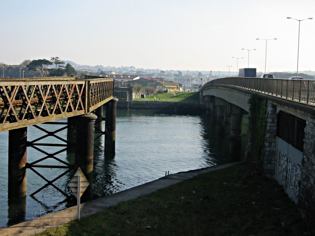
English: Two Bridges Cross The Laira The Laira is the name for the estuarine stretch of the River Plym above The Cattewater. Here it's at its narrowest. On the left is an old decaying railway bridge and on the right, the four lane road bridge taking traffic between Plymouth and the large suburb of Plymstock. |
| Date | |
| Source | From geograph.org.uk |
| Author | Tony Atkin |
| Attribution (required by the license) | Tony Atkin / Two Bridges Cross The Laira / |
| Camera location | | View this and other nearby images on: OpenStreetMap |
|---|
_heading:135.00&language=en)
| Object location | | View this and other nearby images on: OpenStreetMap |
|---|
_heading:135.00&language=en)
Licensing

|
This image was taken from the Geograph project collection. See this photograph's page on the Geograph website for the photographer's contact details. The copyright on this image is owned by Tony Atkin and is licensed for reuse under the Creative Commons Attribution-ShareAlike 2.0 license.
|
This file is licensed under the Creative Commons Attribution-Share Alike 2.0 Generic license.
Attribution: Tony Atkin
- You are free:
- to share – to copy, distribute and transmit the work
- to remix – to adapt the work
- Under the following conditions:
- attribution – You must give appropriate credit, provide a link to the license, and indicate if changes were made. You may do so in any reasonable manner, but not in any way that suggests the licensor endorses you or your use.
- share alike – If you remix, transform, or build upon the material, you must distribute your contributions under the same or compatible license as the original.
File history
Click on a date/time to view the file as it appeared at that time.
| Date/Time | Thumbnail | Dimensions | User | Comment | |
|---|---|---|---|---|---|
| current | 22:13, 14 December 2010 | | 640 × 480 (71 KB) | commons>GeographBot | == {{int:filedesc}} == {{Information |description={{en|1=Two Bridges Cross The Laira The Laira is the name for the estuarine stretch of the River Plym above The Cattewater. Here it's at its narrowest. On the left is an old decaying railway bridge and on |
File usage
There are no pages that use this file.