File:Tongass NF - map of wilderness areas.jpg
Jump to navigation
Jump to search
Size of this preview: 776 × 600 pixels. Other resolutions: 311 × 240 pixels | 621 × 480 pixels | 994 × 768 pixels | 1,280 × 989 pixels | 2,200 × 1,700 pixels.
Original file (2,200 × 1,700 pixels, file size: 954 KB, MIME type: image/jpeg)
File history
Click on a date/time to view the file as it appeared at that time.
| Date/Time | Thumbnail | Dimensions | User | Comment | |
|---|---|---|---|---|---|
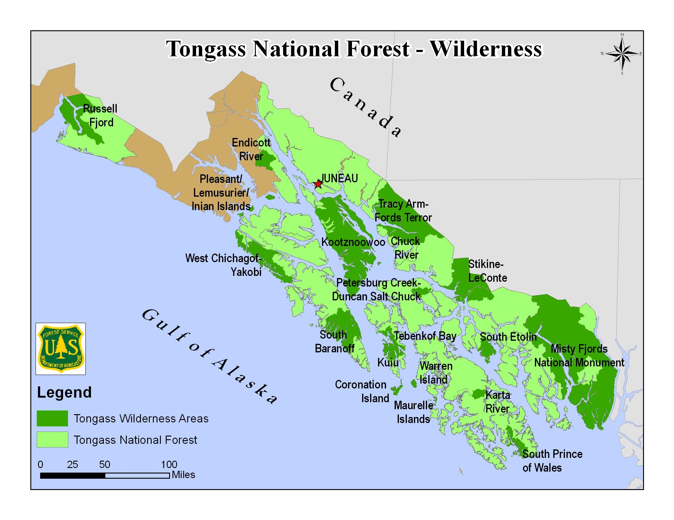
| current | 19:41, 21 September 2018 | | 2,200 × 1,700 (954 KB) | commons>Jsayre64 | {{Information |description ={{en|1=Map of the Tongass National Forest in southeast Alaska, USA, showing designated wilderness areas}} |date =Unknown |source =https://www.fs.usda.gov/detail/tongass/specialplaces/?cid=stelprdb5393510 |author =U.S. Forest Service |permission ={{PD-USGov-USDA-FS}} }} Category:Maps of Tongass National Forest Category:Wilderness Areas of Alaska |
File usage
There are no pages that use this file.