File:Tobruk Agedabia road2.jpg
Jump to navigation
Jump to search

Size of this preview: 800 × 474 pixels. Other resolutions: 320 × 190 pixels | 640 × 379 pixels | 1,208 × 716 pixels.
Original file (1,208 × 716 pixels, file size: 317 KB, MIME type: image/jpeg)
Summary
| Description |
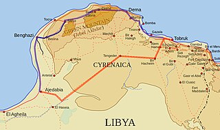
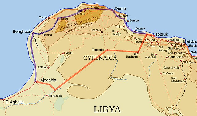
English: A map of northern Cyrenaica (Libya) featuring the Via Balbia and Tobruk Agedabia road. Via Balbia Tobruk-Agedabia road |
||
| Source |
Own work based on:
|
||
| Author | Maher27777 | ||
| Permission (Reusing this file) |
|
||
| Other versions | File:Tobruk Agedabia road1.jpg |
Licensing
| I, the copyright holder of this work, release this work into the public domain. This applies worldwide. In some countries this may not be legally possible; if so: I grant anyone the right to use this work for any purpose, without any conditions, unless such conditions are required by law. |
File history
Click on a date/time to view the file as it appeared at that time.
| Date/Time | Thumbnail | Dimensions | User | Comment | |
|---|---|---|---|---|---|
| current | 14:32, 4 April 2015 | | 1,208 × 716 (317 KB) | commons>Hohum | Closer crop |
File usage
There are no pages that use this file.