File:Thurrock UK locator map.svg
Jump to navigation
Jump to search

Size of this PNG preview of this SVG file: 749 × 600 pixels. Other resolutions: 300 × 240 pixels | 600 × 480 pixels | 959 × 768 pixels | 1,279 × 1,024 pixels | 2,558 × 2,048 pixels | 1,425 × 1,141 pixels.
Original file (SVG file, nominally 1,425 × 1,141 pixels, file size: 1.41 MB)
File history
Click on a date/time to view the file as it appeared at that time.
| Date/Time | Thumbnail | Dimensions | User | Comment | |
|---|---|---|---|---|---|
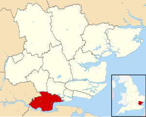
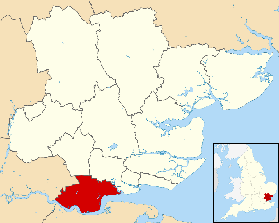
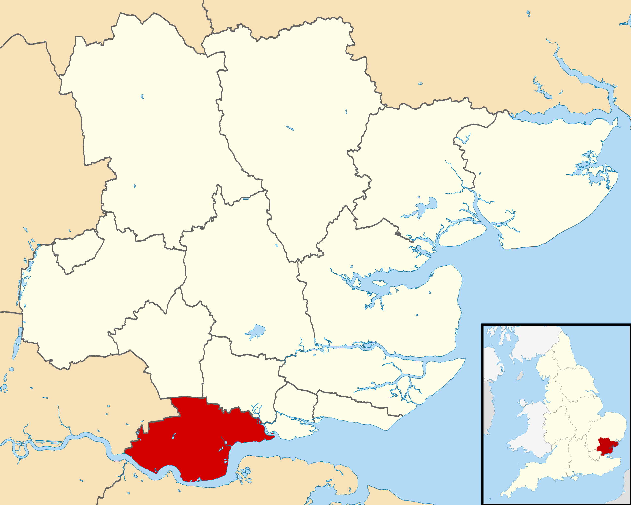
| current | 23:15, 3 August 2011 | | 1,425 × 1,141 (1.41 MB) | commons>Nilfanion | {{Information |Description=Map of Essex, UK with Thurrock highlighted. Equirectangular map projection on WGS 84 datum, with N/S stretched 160% |Source=Ordnance Survey [https://www.ordnancesurvey.co.uk/open |
File usage
There are no pages that use this file.