File:Thomas Ridout map of Grand River Indian Lands, 1821.jpg
Jump to navigation
Jump to search

Size of this preview: 436 × 599 pixels. Other resolutions: 174 × 240 pixels | 349 × 480 pixels | 559 × 768 pixels | 745 × 1,024 pixels | 1,490 × 2,048 pixels | 4,000 × 5,498 pixels.
Original file (4,000 × 5,498 pixels, file size: 3.27 MB, MIME type: image/jpeg)
File history
Click on a date/time to view the file as it appeared at that time.
| Date/Time | Thumbnail | Dimensions | User | Comment | |
|---|---|---|---|---|---|
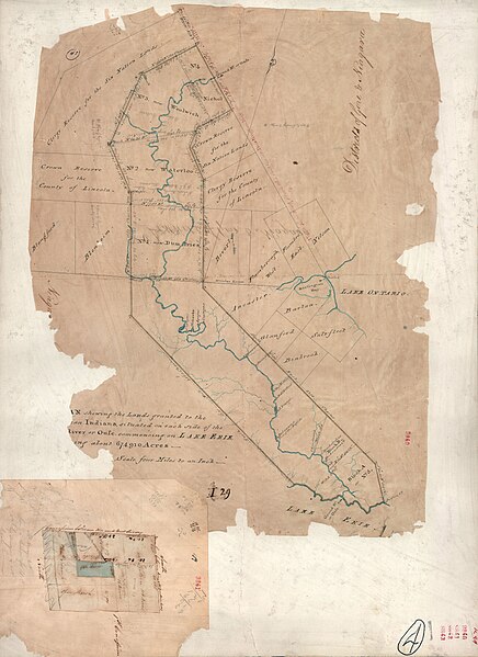
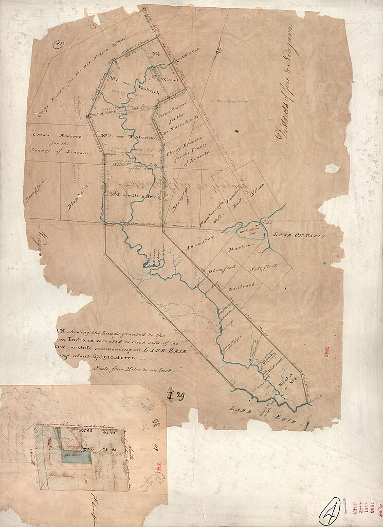
| current | 15:29, 20 August 2009 | | 4,000 × 5,498 (3.27 MB) | commons>NormanEinstein | {{Information |Description={{en|1=This is a survey of the Six Nation Indian lands completed in 1821. It is sometimes called the '''Rideout Survey''' because Thomas Ridout was the Surveyor General of Upper Canada at the time. The image depicts the lands g |
File usage
There are no pages that use this file.