File:Thoen Stone Marker 2022-07-09.jpg
Jump to navigation
Jump to search
Size of this preview: 800 × 528 pixels. Other resolutions: 320 × 211 pixels | 640 × 423 pixels | 1,024 × 676 pixels | 1,280 × 845 pixels | 2,560 × 1,691 pixels | 7,274 × 4,804 pixels.
Original file (7,274 × 4,804 pixels, file size: 11.91 MB, MIME type: image/jpeg)
Summary
| Description |
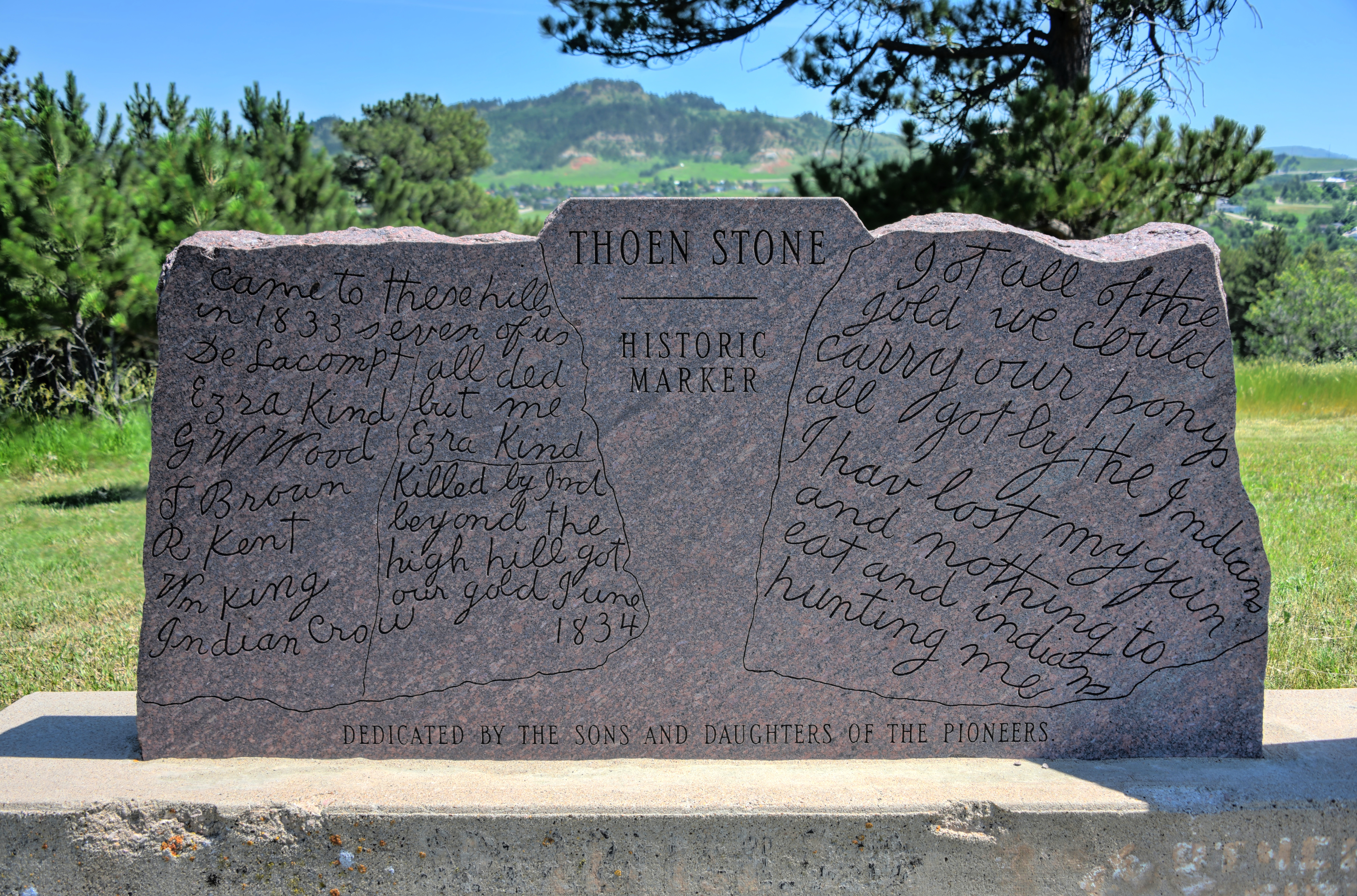
English: A marker with a facsimile of a slab of sandstone purporting to describe an early gold-prospecting expedition into the Black Hills. |
| Date | |
| Source | Own work |
| Author | Schwerdf |
| Camera location | | View this and other nearby images on: OpenStreetMap |
|---|
Licensing
I, the copyright holder of this work, hereby publish it under the following license:
This file is licensed under the Creative Commons Attribution 4.0 International license.
- You are free:
- to share – to copy, distribute and transmit the work
- to remix – to adapt the work
- Under the following conditions:
- attribution – You must give appropriate credit, provide a link to the license, and indicate if changes were made. You may do so in any reasonable manner, but not in any way that suggests the licensor endorses you or your use.
File history
Click on a date/time to view the file as it appeared at that time.
| Date/Time | Thumbnail | Dimensions | User | Comment | |
|---|---|---|---|---|---|
| current | 00:27, 11 March 2024 | | 7,274 × 4,804 (11.91 MB) | commons>Schwerdf | Uploaded own work with UploadWizard |
File usage
There are no pages that use this file.